Kyōtanabe geodata
Kyōtanabe (Kyoto) is a seat of a second-order administrative division; located in Japan in Asia/Tokyo (GMT+9) time zone. In our database, there are 767 cities with bigger population. Compared to other cities in Japan, 64.2% of cities are located further ↑North; 63.2% of cities are located further →East and 70.6% of cities have lower elevation than Kyōtanabe. Note1


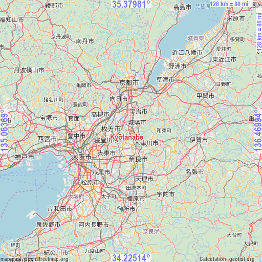
Kyōtanabe GPS coordinates[2]
34° 48' 16.2" North, 135° 46' 0.516" East
| Map corner | latitude | longitude |
|---|---|---|
| Upper-left | 35.37981°, | 135.06369° |
| Center: | 34.8045°, | 135.76681° |
| Lower-right: | 34.22514°, | 136.46994° |
| Map W x H: | 128.4×128.4 km | = 79.8×79.8mi |
| max Lat: | 45.40944° ⇑64.2% North |
| Kyōtanabe: | 34.8045° |
| min Lat: | ⇓35.8% South 24.34478° |
| min Long | Kyōtanabe | max Long |
| 123° | 135.76681° | 145.575° |
| W 36.8%⇐ | ⇒63.2% E |
Elevation
Elevation of Kyōtanabe is 75 m = 246 ft, and this is 9.6 m = 31 ft below average elevation for this country.
| Max E: |
1086 m = 3563 ft | 29.4% |
| Avg. | 84.6 m = 278 ft | |
| Kyōtanabe | 75 m = 246 ft | |
Min E: |
-2 m = -7 ft | 70.6% |
See also: Japan elevation on elevation.city.
Geographical zone
Kyōtanabe is located in North temperate zone (between Tropic of Cancer and the Arctic Circle). Distance of this Northern Tropic circle is 1264 km =785.4 mi to South.| Distance of | km | miles | from Kyōtanabe |
|---|---|---|---|
| North Pole | 6137.2 | 3813.5 | to North |
| Arctic Circle | 3531.3 | 2194.2 | to North |
| Tropic Cancer | 1264 | 785.4 | to South |
| Equator | 3869.9 | 2404.6 | to South |


Nearby cities:
15 places around Kyōtanabe: (largest is in red/bold)
• Daitōchō
16.8 km =10.4 mi,  232°
232°
• Hirakata
10.8 km =6.7 mi,  275°
275°
• Ikoma
14.8 km =9.2 mi,  204°
204°
• Jōyō
5.6 km =3.5 mi,  38°
38°
• Katano
7.5 km =4.7 mi,  260°
260°
• Kizugawa
10.1 km =6.3 mi,  138°
138°
• Nagaoka
15.6 km =9.7 mi,  334°
334°
• Nara-shi
13.7 km =8.5 mi,  165°
165°
• Neyagawa
13.4 km =8.3 mi,  251°
251°
• Settsu
15.9 km =9.9 mi, 259°
• Shijōnawate
11 km =6.8 mi,  223°
223°
• Takatsuki
14.5 km =9 mi,  289°
289°
• Tanabe
2 km =1.2 mi,  357°
357°
• Uji
10.1 km =6.3 mi,  19°
19°
• Yawata
9.3 km =5.8 mi,  321°
321°
Sources, notices
• [Note1] Compared only with cities in Japan existing in our database
• [Src1] Map data: © OpenStreetMap contributors (CC-BY-SA)
• [Src2] Other city data from geonames.org with taken over terms of usage.
• [Src3] Geographical zone / Annual Mean Temperature by Robert A. Rohde @ Wikipedia
