Kizugawa geodata
Kizugawa (Kyoto) is a seat of a second-order administrative division; located in Japan in Asia/Tokyo (GMT+9) time zone. In our database, there are 767 cities with bigger population. Compared to other cities in Japan, 67.2% of cities are located further ↑North; 62.5% of cities are located further →East and 64.2% of cities have lower elevation than Kizugawa. Note1


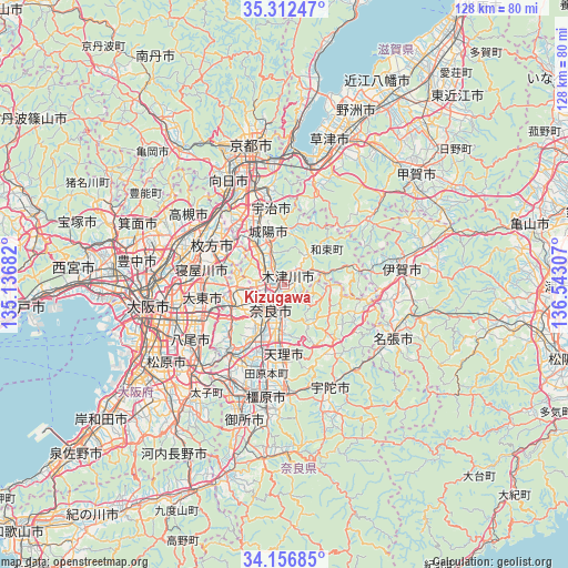
Kizugawa GPS coordinates[2]
34° 44' 12.048" North, 135° 50' 23.784" East
| Map corner | latitude | longitude |
|---|---|---|
| Upper-left | 35.31247°, | 135.13682° |
| Center: | 34.73668°, | 135.83994° |
| Lower-right: | 34.15685°, | 136.54307° |
| Map W x H: | 128.5×128.5 km | = 79.8×79.8mi |
| max Lat: | 45.40944° ⇑67.2% North |
| Kizugawa: | 34.73668° |
| min Lat: | ⇓32.8% South 24.34478° |
| min Long | Kizugawa | max Long |
| 123° | 135.83994° | 145.575° |
| W 37.5%⇐ | ⇒62.5% E |
Elevation
Elevation of Kizugawa is 56 m = 184 ft, and this is 28.6 m = 94 ft below average elevation for this country.
| Max E: |
1086 m = 3563 ft | 35.8% |
| Avg. | 84.6 m = 278 ft | |
| Kizugawa | 56 m = 184 ft | |
Min E: |
-2 m = -7 ft | 64.2% |
See also: Japan elevation on elevation.city.
Geographical zone
Kizugawa is located in North temperate zone (between Tropic of Cancer and the Arctic Circle). Distance of this Northern Tropic circle is 1256.4 km =780.7 mi to South.| Distance of | km | miles | from Kizugawa |
|---|---|---|---|
| North Pole | 6144.7 | 3818.1 | to North |
| Arctic Circle | 3538.8 | 2198.9 | to North |
| Tropic Cancer | 1256.4 | 780.7 | to South |
| Equator | 3862.4 | 2400 | to South |


Nearby cities:
15 places around Kizugawa: (largest is in red/bold)
• Daitōchō
20.2 km =12.6 mi,  262°
262°
• Hirakata
19.4 km =12.1 mi,  296°
296°
• Hōryūji
16.7 km =10.4 mi,  214°
214°
• Ikoma
14.1 km =8.8 mi,  245°
245°
• Jōyō
12.3 km =7.6 mi,  345°
345°
• Katano
15.4 km =9.6 mi,  294°
294°
• Kyōtanabe
10.1 km =6.3 mi,  318°
318°
• Nara-shi
6.6 km =4.1 mi, 209°
• Neyagawa
19.7 km =12.2 mi,  279°
279°
• Shijōnawate
14.3 km =8.9 mi,  268°
268°
• Tanabe
11.7 km =7.3 mi, 324°
• Tenri
17.1 km =10.6 mi,  182°
182°
• Uji
17.4 km =10.8 mi, 348°
• Yamatokōriyama
15.8 km =9.8 mi,  203°
203°
• Yawata
19.4 km =12.1 mi, 319°
Sources, notices
• [Note1] Compared only with cities in Japan existing in our database
• [Src1] Map data: © OpenStreetMap contributors (CC-BY-SA)
• [Src2] Other city data from geonames.org with taken over terms of usage.
• [Src3] Geographical zone / Annual Mean Temperature by Robert A. Rohde @ Wikipedia
