Sagamihara geodata
Sagamihara (Kanagawa) is a seat of a second-order administrative division; located in Japan in Asia/Tokyo (GMT+9) time zone. In our database, there are 767 cities with bigger population. Compared to other cities in Japan, 54.8% of cities are located further ↓South; 63.5% of cities are located further ←West and 90.6% of cities have lower elevation than Sagamihara. Note1


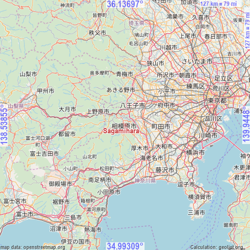
Sagamihara GPS coordinates[2]
35° 34' 1.452" North, 139° 14' 30.012" East
| Map corner | latitude | longitude |
|---|---|---|
| Upper-left | 36.13697°, | 138.53855° |
| Center: | 35.56707°, | 139.24167° |
| Lower-right: | 34.99309°, | 139.9448° |
| Map W x H: | 127.2×127.2 km | = 79×79mi |
| max Lat: | 45.40944° ⇑45.2% North |
| Sagamihara: | 35.56707° |
| min Lat: | ⇓54.8% South 24.34478° |
| min Long | Sagamihara | max Long |
| 123° | 139.24167° | 145.575° |
| W 63.5%⇐ | ⇒36.5% E |
Elevation
Elevation of Sagamihara is 236 m = 774 ft, and this is 151.4 m = 497 ft above average elevation for this country.
| Max E: |
1086 m = 3563 ft | 9.4% |
| Sagamihara | 236 m 774 ft | |
| Avg. | 84.6 m = 278 ft | |
Min E: |
-2 m = -7 ft | 90.6% |
See also: Japan elevation on elevation.city.
Geographical zone
Sagamihara is located in North temperate zone (between Tropic of Cancer and the Arctic Circle). Distance of this Northern Tropic circle is 1348.8 km =838.1 mi to South.| Distance of | km | miles | from Sagamihara |
|---|---|---|---|
| North Pole | 6052.4 | 3760.8 | to North |
| Arctic Circle | 3446.5 | 2141.6 | to North |
| Tropic Cancer | 1348.8 | 838.1 | to South |
| Equator | 3954.7 | 2457.3 | to South |


Nearby cities:
15 places around Sagamihara: (largest is in red/bold)
• Akiruno
18 km =11.2 mi,  357°
357°
• Akishima
21.2 km =13.2 mi,  36°
36°
• Atsugi
18 km =11.2 mi,  140°
140°
• Ebina
20.2 km =12.6 mi, 136°
• Fussa
20.3 km =12.6 mi,  21°
21°
• Hachiōji
12.4 km =7.7 mi, 36°
• Hadano
21.9 km =13.6 mi,  184°
184°
• Hino
18.6 km =11.6 mi,  50°
50°
• Isehara
19.7 km =12.2 mi,  161°
161°
• Itsukaichi
17.7 km =11 mi,  353°
353°
• Machida
19.2 km =11.9 mi,  98°
98°
• Minamirinkan
19.9 km =12.4 mi,  113°
113°
• Uenohara
12.6 km =7.8 mi,  296°
296°
• Yamato
21.7 km =13.5 mi,  118°
118°
• Zama
16.1 km =10 mi, 123°
Sources, notices
• [Note1] Compared only with cities in Japan existing in our database
• [Src1] Map data: © OpenStreetMap contributors (CC-BY-SA)
• [Src2] Other city data from geonames.org with taken over terms of usage.
• [Src3] Geographical zone / Annual Mean Temperature by Robert A. Rohde @ Wikipedia
