Lumphat geodata
Lumphat (Ratanakiri) is a seat of a second-order administrative division; located in Cambodia in Asia/Phnom_Penh (GMT+7) time zone. With population of 19,205 people, there are 23 cities with bigger population in this country. Compared to other cities in Cambodia, 78% of cities are located further ↓South; 94.7% of cities are located further ←West and 87.9% of cities have lower elevation than Lumphat. Note1


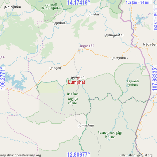
Lumphat GPS coordinates[2]
13° 29' 29.256" North, 106° 58' 48.792" East
| Map corner | latitude | longitude |
|---|---|---|
| Upper-left | 14.17419°, | 106.2771° |
| Center: | 13.49146°, | 106.98022° |
| Lower-right: | 12.80677°, | 107.68335° |
| Map W x H: | 152×152 km | = 94.4×94.4mi |
| max Lat: | 14.23223° ⇑22% North |
| Lumphat: | 13.49146° |
| min Lat: | ⇓78% South 10.48291° |
| min Long | Lumphat | max Long |
| 102.37574° | 106.98022° | 107.42393° |
| W 94.7%⇐ | ⇒5.3% E |
Elevation
Elevation of Lumphat is 101 m = 331 ft, and this is 49 m = 161 ft above average elevation for this country.
| Max E: |
678 m = 2224 ft | 12.1% |
| Lumphat | 101 m 331 ft | |
| Avg. | 52 m = 171 ft | |
Min E: |
4 m = 13 ft | 87.9% |
See also: Cambodia elevation on elevation.city.
Geographical zone
Lumphat is located in North Torrid zone (between Equator and Tropic of Cancer). Distance of this Northern Tropic circle is 1105.8 km =687.1 mi to North.| Distance of | km | miles | from Lumphat |
|---|---|---|---|
| North Pole | 8507 | 5286 | to North |
| Arctic Circle | 5901.1 | 3666.8 | to North |
| Tropic Cancer | 1105.8 | 687.1 | to North |
| Equator | 1500.1 | 932.1 | to South |


Nearby cities:
15 places around Lumphat: (largest is in red/bold)
• Andoung Meas
54 km =33.6 mi,  39°
39°
• Banlung
27.6 km =17.1 mi,  1°
1°
• Bar Kaev
33.3 km =20.7 mi,  49°
49°
• Kaev Seima
145.4 km =90.3 mi,  184°
184°
• Koun Mom
24.4 km =15.2 mi,  293°
293°
• Kratié
152.6 km =94.8 mi,  223°
223°
• Ou Chum
34.1 km =21.2 mi, 2°
• Ou Ya Dav
44.4 km =27.6 mi,  63°
63°
• Pechreada
114.9 km =71.4 mi,  155°
155°
• Preaek Prasab
162.7 km =101.1 mi, 218°
• Sen Monorom
117.3 km =72.9 mi,  168°
168°
• Sesan
96.2 km =59.8 mi,  274°
274°
• Siem Pang
94.5 km =58.7 mi,  317°
317°
• Stung Treng
109.5 km =68 mi, 272°
• Veun Sai
56.9 km =35.4 mi,  341°
341°
Sources, notices
• [Note1] Compared only with cities in Cambodia existing in our database
• [Src1] Map data: © OpenStreetMap contributors (CC-BY-SA)
• [Src2] Other city data from geonames.org with taken over terms of usage.
• [Src3] Geographical zone / Annual Mean Temperature by Robert A. Rohde @ Wikipedia
