Koun Mom geodata
Koun Mom (Ratanakiri) is a seat of a second-order administrative division; located in Cambodia in Asia/Phnom_Penh (GMT+7) time zone. In our database, there are 29 cities with bigger population. Compared to other cities in Cambodia, 81.1% of cities are located further ↓South; 92.4% of cities are located further ←West and 89.4% of cities have lower elevation than Koun Mom. Note1


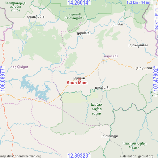
Koun Mom GPS coordinates[2]
13° 34' 39.612" North, 106° 46' 22.404" East
| Map corner | latitude | longitude |
|---|---|---|
| Upper-left | 14.26014°, | 106.06977° |
| Center: | 13.57767°, | 106.77289° |
| Lower-right: | 12.89323°, | 107.47602° |
| Map W x H: | 152×152 km | = 94.4×94.4mi |
| max Lat: | 14.23223° ⇑18.9% North |
| Koun Mom: | 13.57767° |
| min Lat: | ⇓81.1% South 10.48291° |
| min Long | Koun Mom | max Long |
| 102.37574° | 106.77289° | 107.42393° |
| W 92.4%⇐ | ⇒7.6% E |
Elevation
Elevation of Koun Mom is 117 m = 384 ft, and this is 65 m = 213 ft above average elevation for this country.
| Max E: |
678 m = 2224 ft | 10.6% |
| Koun Mom | 117 m 384 ft | |
| Avg. | 52 m = 171 ft | |
Min E: |
4 m = 13 ft | 89.4% |
See also: Cambodia elevation on elevation.city.
Geographical zone
Koun Mom is located in North Torrid zone (between Equator and Tropic of Cancer). Distance of this Northern Tropic circle is 1096.2 km =681.1 mi to North.| Distance of | km | miles | from Koun Mom |
|---|---|---|---|
| North Pole | 8497.4 | 5280 | to North |
| Arctic Circle | 5891.5 | 3660.8 | to North |
| Tropic Cancer | 1096.2 | 681.1 | to North |
| Equator | 1509.7 | 938.1 | to South |


Nearby cities:
15 places around Koun Mom: (largest is in red/bold)
• Andoung Meas
65.1 km =40.5 mi,  60°
60°
• Banlung
29.3 km =18.2 mi,  52°
52°
• Bar Kaev
49.2 km =30.6 mi,  75°
75°
• Kaev Seima
155 km =96.3 mi,  175°
175°
• Kratié
146.1 km =90.8 mi,  213°
213°
• Lumphat
24.4 km =15.2 mi,  113°
113°
• Ou Chum
34.2 km =21.3 mi,  44°
44°
• Ou Ya Dav
62.9 km =39.1 mi, 80°
• Pechreada
134 km =83.3 mi,  148°
148°
• Preaek Prasab
157.8 km =98.1 mi, 210°
• Sen Monorom
132.6 km =82.4 mi,  160°
160°
• Sesan
73.6 km =45.7 mi,  267°
267°
• Siem Pang
73 km =45.4 mi,  325°
325°
• Stung Treng
87.2 km =54.2 mi, 266°
• Veun Sai
44.5 km =27.7 mi,  5°
5°
Sources, notices
• [Note1] Compared only with cities in Cambodia existing in our database
• [Src1] Map data: © OpenStreetMap contributors (CC-BY-SA)
• [Src2] Other city data from geonames.org with taken over terms of usage.
• [Src3] Geographical zone / Annual Mean Temperature by Robert A. Rohde @ Wikipedia
