Sesan geodata
Sesan (Stung Treng) is a seat of a second-order administrative division; located in Cambodia in Asia/Phnom_Penh (GMT+7) time zone. In our database, there are 29 cities with bigger population. Compared to other cities in Cambodia, 80.3% of cities are located further ↓South; 90.2% of cities are located further ←West and 79.5% of cities have lower elevation than Sesan. Note1


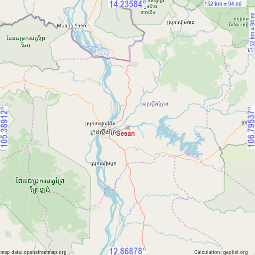
Sesan GPS coordinates[2]
13° 33' 11.844" North, 106° 5' 32.064" East
| Map corner | latitude | longitude |
|---|---|---|
| Upper-left | 14.23584°, | 105.38912° |
| Center: | 13.55329°, | 106.09224° |
| Lower-right: | 12.86878°, | 106.79537° |
| Map W x H: | 152×152 km | = 94.4×94.4mi |
| max Lat: | 14.23223° ⇑19.7% North |
| Sesan: | 13.55329° |
| min Lat: | ⇓80.3% South 10.48291° |
| min Long | Sesan | max Long |
| 102.37574° | 106.09224° | 107.42393° |
| W 90.2%⇐ | ⇒9.8% E |
Elevation
Elevation of Sesan is 60 m = 197 ft, and this is 8 m = 26 ft above average elevation for this country.
| Max E: |
678 m = 2224 ft | 20.5% |
| Sesan | 60 m 197 ft | |
| Avg. | 52 m = 171 ft | |
Min E: |
4 m = 13 ft | 79.5% |
See also: Cambodia elevation on elevation.city.
Geographical zone
Sesan is located in North Torrid zone (between Equator and Tropic of Cancer). Distance of this Northern Tropic circle is 1098.9 km =682.8 mi to North.| Distance of | km | miles | from Sesan |
|---|---|---|---|
| North Pole | 8500.1 | 5281.7 | to North |
| Arctic Circle | 5894.2 | 3662.5 | to North |
| Tropic Cancer | 1098.9 | 682.8 | to North |
| Equator | 1507 | 936.4 | to South |


Nearby cities:
15 places around Sesan: (largest is in red/bold)
• Andoung Meas
134.7 km =83.7 mi,  74°
74°
• Banlung
98.9 km =61.5 mi,  77°
77°
• Bar Kaev
122.1 km =75.9 mi, 83°
• Koun Mom
73.6 km =45.7 mi,  87°
87°
• Kratié
118.7 km =73.8 mi,  183°
183°
• Lumphat
96.2 km =59.8 mi, 94°
• Ou Chum
101.1 km =62.8 mi, 74°
• Pal Hal
123.2 km =76.6 mi,  282°
282°
• Preaek Prasab
133.5 km =83 mi, 182°
• Sandan
103.5 km =64.3 mi,  241°
241°
• Sangkom Thmei
127.5 km =79.2 mi,  271°
271°
• Siem Pang
70.4 km =43.7 mi,  27°
27°
• Stung Treng
13.7 km =8.5 mi,  257°
257°
• Tbeng Meanchey
123.4 km =76.7 mi, 283°
• Veun Sai
90.8 km =56.4 mi,  58°
58°
Sources, notices
• [Note1] Compared only with cities in Cambodia existing in our database
• [Src1] Map data: © OpenStreetMap contributors (CC-BY-SA)
• [Src2] Other city data from geonames.org with taken over terms of usage.
• [Src3] Geographical zone / Annual Mean Temperature by Robert A. Rohde @ Wikipedia
