Anlong Veaeng geodata
Anlong Veaeng (Ŏtâr Méanchey) is a seat of a second-order administrative division; located in Cambodia in Asia/Phnom_Penh (GMT+7) time zone. In our database, there are 29 cities with bigger population. Compared to other cities in Cambodia, 100% of cities are located further ↓South; 64.4% of cities are located further →East and 77.3% of cities have lower elevation than Anlong Veaeng. Note1


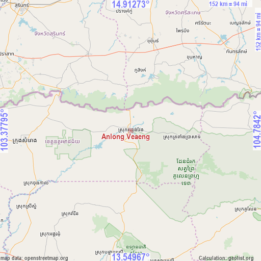
Anlong Veaeng GPS coordinates[2]
14° 13' 56.028" North, 104° 4' 51.852" East
| Map corner | latitude | longitude |
|---|---|---|
| Upper-left | 14.91273°, | 103.37795° |
| Center: | 14.23223°, | 104.08107° |
| Lower-right: | 13.54967°, | 104.7842° |
| Map W x H: | 151.6×151.6 km | = 94.2×94.2mi |
| max Lat: | 14.23223° ⇑0% North |
| Anlong Veaeng: | 14.23223° |
| min Lat: | ⇓100% South 10.48291° |
| min Long | Anlong Veaeng | max Long |
| 102.37574° | 104.08107° | 107.42393° |
| W 35.6%⇐ | ⇒64.4% E |
Elevation
Elevation of Anlong Veaeng is 54 m = 177 ft, and this is 2 m = 7 ft above average elevation for this country.
| Max E: |
678 m = 2224 ft | 22.7% |
| Anlong Veaeng | 54 m 177 ft | |
| Avg. | 52 m = 171 ft | |
Min E: |
4 m = 13 ft | 77.3% |
See also: Cambodia elevation on elevation.city.
Geographical zone
Anlong Veaeng is located in North Torrid zone (between Equator and Tropic of Cancer). Distance of this Northern Tropic circle is 1023.4 km =635.9 mi to North.| Distance of | km | miles | from Anlong Veaeng |
|---|---|---|---|
| North Pole | 8424.6 | 5234.8 | to North |
| Arctic Circle | 5818.7 | 3615.6 | to North |
| Tropic Cancer | 1023.4 | 635.9 | to North |
| Equator | 1582.5 | 983.3 | to South |


Nearby cities:
15 places around Anlong Veaeng: (largest is in red/bold)
• Angkor Chum
76.8 km =47.7 mi,  217°
217°
• Angkor Thum
86.2 km =53.6 mi,  195°
195°
• Bakong
98.9 km =61.5 mi,  185°
185°
• Kralanh
99.8 km =62 mi,  225°
225°
• Kuleaen
80.7 km =50.1 mi,  124°
124°
• Pal Hal
108.5 km =67.4 mi, 116°
• Phnum Srok
96.7 km =60.1 mi,  235°
235°
• Samraong
61 km =37.9 mi,  264°
264°
• Sangkom Thmei
115.3 km =71.6 mi,  128°
128°
• Siem Reap
99.7 km =62 mi, 193°
• Soutr Nikom
110.6 km =68.7 mi,  176°
176°
• Srei Snam
75.6 km =47 mi, 234°
• Tbeng Meanchey
107.9 km =67 mi, 115°
• Trapeang Prasat
30 km =18.6 mi,  99°
99°
• Varin
59.8 km =37.2 mi, 215°
Sources, notices
• [Note1] Compared only with cities in Cambodia existing in our database
• [Src1] Map data: © OpenStreetMap contributors (CC-BY-SA)
• [Src2] Other city data from geonames.org with taken over terms of usage.
• [Src3] Geographical zone / Annual Mean Temperature by Robert A. Rohde @ Wikipedia
