Pal Hal geodata
Pal Hal (Preah Vihear) is a seat of a second-order administrative division; located in Cambodia in Asia/Phnom_Penh (GMT+7) time zone. In our database, there are 29 cities with bigger population. Compared to other cities in Cambodia, 90.2% of cities are located further ↓South; 65.9% of cities are located further ←West and 80.3% of cities have lower elevation than Pal Hal. Note1


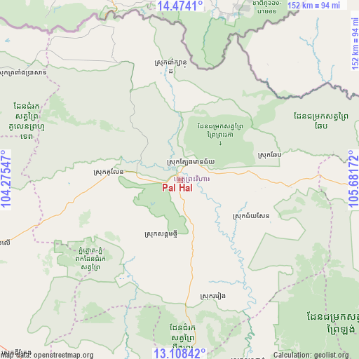
Pal Hal GPS coordinates[2]
13° 47' 32.136" North, 104° 58' 42.924" East
| Map corner | latitude | longitude |
|---|---|---|
| Upper-left | 14.4741°, | 104.27547° |
| Center: | 13.79226°, | 104.97859° |
| Lower-right: | 13.10842°, | 105.68172° |
| Map W x H: | 151.8×151.9 km | = 94.3×94.4mi |
| max Lat: | 14.23223° ⇑9.8% North |
| Pal Hal: | 13.79226° |
| min Lat: | ⇓90.2% South 10.48291° |
| min Long | Pal Hal | max Long |
| 102.37574° | 104.97859° | 107.42393° |
| W 65.9%⇐ | ⇒34.1% E |
Elevation
Elevation of Pal Hal is 63 m = 207 ft, and this is 11 m = 36 ft above average elevation for this country.
| Max E: |
678 m = 2224 ft | 19.7% |
| Pal Hal | 63 m 207 ft | |
| Avg. | 52 m = 171 ft | |
Min E: |
4 m = 13 ft | 80.3% |
See also: Cambodia elevation on elevation.city.
Geographical zone
Pal Hal is located in North Torrid zone (between Equator and Tropic of Cancer). Distance of this Northern Tropic circle is 1072.4 km =666.4 mi to North.| Distance of | km | miles | from Pal Hal |
|---|---|---|---|
| North Pole | 8473.5 | 5265.2 | to North |
| Arctic Circle | 5867.6 | 3646 | to North |
| Tropic Cancer | 1072.4 | 666.4 | to North |
| Equator | 1533.6 | 952.9 | to South |


Nearby cities:
15 places around Pal Hal: (largest is in red/bold)
• Angkor Thum
124.2 km =77.2 mi,  253°
253°
• Anlong Veaeng
108.5 km =67.4 mi,  296°
296°
• Bakong
118 km =73.3 mi, 245°
• Chi Kraeng
101.1 km =62.8 mi,  222°
222°
• Kampong Thom
120.6 km =74.9 mi,  184°
184°
• Kuleaen
30.4 km =18.9 mi,  276°
276°
• Sandan
82.1 km =51 mi,  158°
158°
• Sangkom Thmei
24.5 km =15.2 mi,  196°
196°
• Sesan
123.2 km =76.6 mi,  102°
102°
• Soutr Nikom
109.8 km =68.2 mi,  235°
235°
• Stoung
104.5 km =64.9 mi, 204°
• Stueng Saen
120.6 km =74.9 mi, 184°
• Stung Treng
111 km =69 mi,  105°
105°
• Tbeng Meanchey
1.7 km =1.1 mi,  6°
6°
• Trapeang Prasat
80.3 km =49.9 mi, 303°
Sources, notices
• [Note1] Compared only with cities in Cambodia existing in our database
• [Src1] Map data: © OpenStreetMap contributors (CC-BY-SA)
• [Src2] Other city data from geonames.org with taken over terms of usage.
• [Src3] Geographical zone / Annual Mean Temperature by Robert A. Rohde @ Wikipedia
