Sangsŏng-ni geodata
Sangsŏng-ni (South Pyongan) is a populated place; located in North Korea in Asia/Pyongyang (GMT+9) time zone. With population of 9,888 people, there are 74 cities with bigger population in this country. Compared to other cities in North Korea, 71.4% of cities are located further ↑North; 52.7% of cities are located further →East and 83.5% of cities have lower elevation than Sangsŏng-ni. Note1


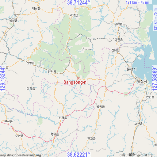
Sangsŏng-ni GPS coordinates[2]
39° 10' 9.984" North, 126° 53' 8.016" East
| Map corner | latitude | longitude |
|---|---|---|
| Upper-left | 39.71244°, | 126.18244° |
| Center: | 39.16944°, | 126.88556° |
| Lower-right: | 38.62221°, | 127.58869° |
| Map W x H: | 121.2×121.2 km | = 75.3×75.3mi |
| max Lat: | 42.95722° ⇑71.4% North |
| Sangsŏng-ni: | 39.16944° |
| min Lat: | ⇓28.6% South 37.90889° |
| min Long | Sangsŏng-ni | max Long |
| 124.39806° | 126.88556° | 130.49522° |
| W 47.3%⇐ | ⇒52.7% E |
Elevation
Elevation of Sangsŏng-ni is 263 m = 863 ft, and this is 131.3 m = 431 ft above average elevation for this country.
| Max E: |
1466 m = 4810 ft | 16.5% |
| Sangsŏng-ni | 263 m 863 ft | |
| Avg. | 131.7 m = 432 ft | |
Min E: |
1 m = 3 ft | 83.5% |
See also: North Korea elevation on elevation.city.
Geographical zone
Sangsŏng-ni is located in North temperate zone (between Tropic of Cancer and the Arctic Circle). Distance of this Northern Tropic circle is 1749.3 km =1087 mi to South.| Distance of | km | miles | from Sangsŏng-ni |
|---|---|---|---|
| North Pole | 5651.8 | 3511.9 | to North |
| Arctic Circle | 3045.9 | 1892.6 | to North |
| Tropic Cancer | 1749.3 | 1087 | to South |
| Equator | 4355.2 | 2706.2 | to South |


Nearby cities:
15 places around Sangsŏng-ni: (largest is in red/bold)
• Anbyŏn-ŭp
56.9 km =35.4 mi,  104°
104°
• Chunghwa
99.7 km =62 mi,  250°
250°
• Hoeyang
80 km =49.7 mi,  129°
129°
• Hŭngnam
96.8 km =60.1 mi,  40°
40°
• Kangdong-ŭp
68.1 km =42.3 mi,  267°
267°
• Koksan
47.1 km =29.3 mi,  203°
203°
• Kosan
57.7 km =35.9 mi, 127°
• Kowŏn-ŭp
42.9 km =26.7 mi,  45°
45°
• Pyongyang
98.8 km =61.4 mi,  261°
261°
• P’yŏngsŏng
87.7 km =54.5 mi,  275°
275°
• Sinsang-ni
69.7 km =43.3 mi, 39°
• Sunch’ŏn
87 km =54.1 mi,  289°
289°
• Sŭngho 1-tong
80.8 km =50.2 mi, 255°
• T’ongch’ŏn-ŭp
90.1 km =56 mi,  105°
105°
• Wŏnsan
48.1 km =29.9 mi,  92°
92°
Sources, notices
• [Note1] Compared only with cities in North Korea existing in our database
• [Src1] Map data: © OpenStreetMap contributors (CC-BY-SA)
• [Src2] Other city data from geonames.org with taken over terms of usage.
• [Src3] Geographical zone / Annual Mean Temperature by Robert A. Rohde @ Wikipedia
