Kowŏn-ŭp geodata
Kowŏn-ŭp (Hamgyŏng-namdo) is a populated place; located in North Korea in Asia/Pyongyang (GMT+9) time zone. With population of 21,490 people, there are 45 cities with bigger population in this country. Compared to other cities in North Korea, 67% of cities are located further ↑North; 51.6% of cities are located further →East and 89% of cities have higher elevation than Kowŏn-ŭp. Note1


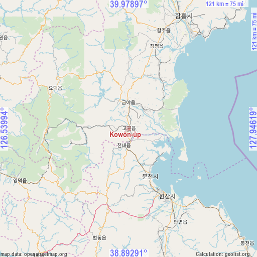
Kowŏn-ŭp GPS coordinates[2]
39° 26' 17.016" North, 127° 14' 35.016" East
| Map corner | latitude | longitude |
|---|---|---|
| Upper-left | 39.97897°, | 126.53994° |
| Center: | 39.43806°, | 127.24306° |
| Lower-right: | 38.89291°, | 127.94619° |
| Map W x H: | 120.8×120.8 km | = 75.1×75.1mi |
| max Lat: | 42.95722° ⇑67% North |
| Kowŏn-ŭp: | 39.43806° |
| min Lat: | ⇓33% South 37.90889° |
| min Long | Kowŏn-ŭp | max Long |
| 124.39806° | 127.24306° | 130.49522° |
| W 48.4%⇐ | ⇒51.6% E |
Elevation
Elevation of Kowŏn-ŭp is 9 m = 30 ft, and this is 122.7 m = 403 ft below average elevation for this country.
| Max E: |
1466 m = 4810 ft | 89% |
| Avg. | 131.7 m = 432 ft | |
| Kowŏn-ŭp | 9 m = 30 ft | |
Min E: |
1 m = 3 ft | 11% |
See also: North Korea elevation on elevation.city.
Geographical zone
Kowŏn-ŭp is located in North temperate zone (between Tropic of Cancer and the Arctic Circle). Distance of this Northern Tropic circle is 1779.2 km =1105.5 mi to South.| Distance of | km | miles | from Kowŏn-ŭp |
|---|---|---|---|
| North Pole | 5622 | 3493.3 | to North |
| Arctic Circle | 3016.1 | 1874.1 | to North |
| Tropic Cancer | 1779.2 | 1105.5 | to South |
| Equator | 4385.1 | 2724.8 | to South |


Nearby cities:
15 places around Kowŏn-ŭp: (largest is in red/bold)
• Anbyŏn-ŭp
50.2 km =31.2 mi,  151°
151°
• Hamhŭng
59 km =36.7 mi,  25°
25°
• Hoeyang
86.5 km =53.7 mi,  159°
159°
• Hongwŏn
89.3 km =55.5 mi,  43°
43°
• Hŭngnam
54.3 km =33.7 mi, 36°
• Kangdong-ŭp
104 km =64.6 mi,  251°
251°
• Koksan
88.3 km =54.9 mi,  214°
214°
• Kosan
66.5 km =41.3 mi,  166°
166°
• Samho-rodongjagu
78.1 km =48.5 mi, 43°
• Sangsŏng-ni
42.9 km =26.7 mi,  225°
225°
• Sinsang-ni
27.4 km =17 mi, 30°
• T’ongch’ŏn-ŭp
77.6 km =48.2 mi,  133°
133°
• Wŏnsan
36.1 km =22.4 mi, 151°
• Yuktae-dong
102 km =63.4 mi,  50°
50°
• Yŏnggwang-ŭp
67 km =41.6 mi,  15°
15°
Sources, notices
• [Note1] Compared only with cities in North Korea existing in our database
• [Src1] Map data: © OpenStreetMap contributors (CC-BY-SA)
• [Src2] Other city data from geonames.org with taken over terms of usage.
• [Src3] Geographical zone / Annual Mean Temperature by Robert A. Rohde @ Wikipedia
