P’yŏngsŏng geodata
P’yŏngsŏng (South Pyongan) is a seat of a first-order administrative division; located in North Korea in Asia/Pyongyang (GMT+9) time zone. With population of 100,000 people, there are 15 cities with bigger population in this country. Compared to other cities in North Korea, 69.2% of cities are located further ↑North; 68.1% of cities are located further →East and 54.9% of cities have lower elevation than P’yŏngsŏng. Note1


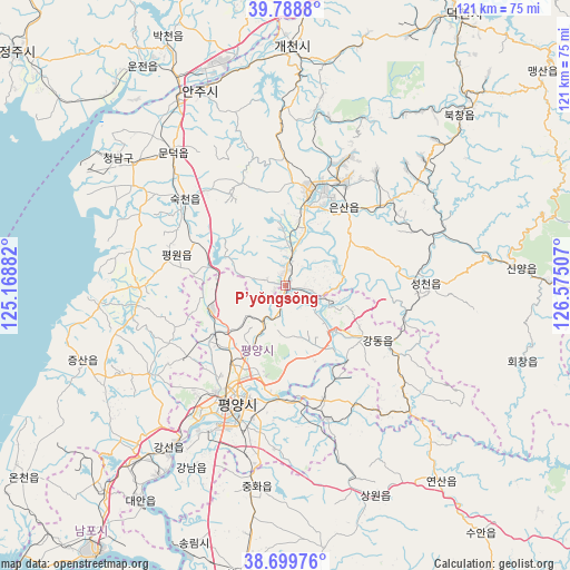
P’yŏngsŏng GPS coordinates[2]
39° 14' 47.004" North, 125° 52' 18.984" East
| Map corner | latitude | longitude |
|---|---|---|
| Upper-left | 39.7888°, | 125.16882° |
| Center: | 39.24639°, | 125.87194° |
| Lower-right: | 38.69976°, | 126.57507° |
| Map W x H: | 121.1×121.1 km | = 75.2×75.2mi |
| max Lat: | 42.95722° ⇑69.2% North |
| P’yŏngsŏng: | 39.24639° |
| min Lat: | ⇓30.8% South 37.90889° |
| min Long | P’yŏngsŏng | max Long |
| 124.39806° | 125.87194° | 130.49522° |
| W 31.9%⇐ | ⇒68.1% E |
Elevation
Elevation of P’yŏngsŏng is 53 m = 174 ft, and this is 78.7 m = 258 ft below average elevation for this country.
| Max E: |
1466 m = 4810 ft | 45.1% |
| Avg. | 131.7 m = 432 ft | |
| P’yŏngsŏng | 53 m = 174 ft | |
Min E: |
1 m = 3 ft | 54.9% |
See also: P’yŏngsŏng elevation on elevation.city.
Geographical zone
P’yŏngsŏng is located in North temperate zone (between Tropic of Cancer and the Arctic Circle). Distance of this Northern Tropic circle is 1757.9 km =1092.3 mi to South.| Distance of | km | miles | from P’yŏngsŏng |
|---|---|---|---|
| North Pole | 5643.3 | 3506.6 | to North |
| Arctic Circle | 3037.4 | 1887.4 | to North |
| Tropic Cancer | 1757.9 | 1092.3 | to South |
| Equator | 4363.8 | 2711.5 | to South |


Nearby cities:
15 places around P’yŏngsŏng: (largest is in red/bold)
• Anju
45 km =28 mi,  336°
336°
• Chunghwa
43 km =26.7 mi,  188°
188°
• Hwangju-ŭp
64.6 km =40.1 mi, 187°
• Hŭkkyo-ri
50.3 km =31.3 mi, 187°
• Kangdong-ŭp
22.5 km =14 mi,  120°
120°
• Namp’o
69.4 km =43.1 mi,  215°
215°
• Pyongyang
25.7 km =16 mi,  203°
203°
• Sil-li
44 km =27.3 mi,  308°
308°
• Sinanju
45.1 km =28 mi,  330°
330°
• Songnim
58.1 km =36.1 mi, 199°
• Sunan
16.6 km =10.3 mi,  251°
251°
• Sunch’ŏn
21.3 km =13.2 mi,  14°
14°
• Sŭngho 1-tong
29.8 km =18.5 mi,  162°
162°
• Yonggang-ŭp
58.1 km =36.1 mi, 221°
• Yŏngbyŏn
63.3 km =39.3 mi,  354°
354°
Sources, notices
• [Note1] Compared only with cities in North Korea existing in our database
• [Src1] Map data: © OpenStreetMap contributors (CC-BY-SA)
• [Src2] Other city data from geonames.org with taken over terms of usage.
• [Src3] Geographical zone / Annual Mean Temperature by Robert A. Rohde @ Wikipedia
