Hoeyang geodata
Hoeyang (Kangwŏn-do) is a populated place; located in North Korea in Asia/Pyongyang (GMT+9) time zone. With population of 21,111 people, there are 46 cities with bigger population in this country. Compared to other cities in North Korea, 86.8% of cities are located further ↑North; 56% of cities are located further ←West and 92.3% of cities have lower elevation than Hoeyang. Note1


Hoeyang GPS coordinates[2]
38° 42' 37.008" North, 127° 35' 53.988" East
| Map corner | latitude | longitude |
|---|---|---|
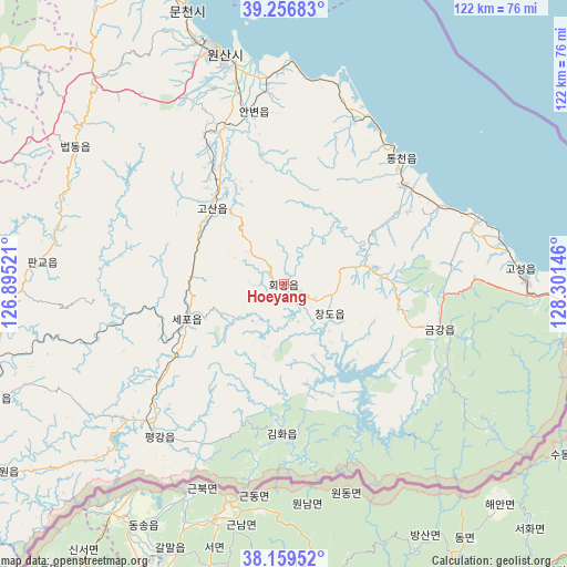
| Upper-left | 39.25683°, | 126.89521° |
| Center: | 38.71028°, | 127.59833° |
| Lower-right: | 38.15952°, | 128.30146° |
| Map W x H: | 122×122 km | = 75.8×75.8mi |
| max Lat: | 42.95722° ⇑86.8% North |
| Hoeyang: | 38.71028° |
| min Lat: | ⇓13.2% South 37.90889° |
| min Long | Hoeyang | max Long |
| 124.39806° | 127.59833° | 130.49522° |
| W 56%⇐ | ⇒44% E |
Elevation
Elevation of Hoeyang is 354 m = 1161 ft, and this is 222.3 m = 729 ft above average elevation for this country.
| Max E: |
1466 m = 4810 ft | 7.7% |
| Hoeyang | 354 m 1161 ft | |
| Avg. | 131.7 m = 432 ft | |
Min E: |
1 m = 3 ft | 92.3% |
See also: North Korea elevation on elevation.city.
Geographical zone
Hoeyang is located in North temperate zone (between Tropic of Cancer and the Arctic Circle). Distance of this Northern Tropic circle is 1698.3 km =1055.3 mi to South.| Distance of | km | miles | from Hoeyang |
|---|---|---|---|
| North Pole | 5702.9 | 3543.6 | to North |
| Arctic Circle | 3097 | 1924.4 | to North |
| Tropic Cancer | 1698.3 | 1055.3 | to South |
| Equator | 4304.2 | 2674.5 | to South |


Nearby cities:
15 places around Hoeyang: (largest is in red/bold)
• Anbyŏn-ŭp
37.5 km =23.3 mi,  350°
350°
• Hamhŭng
134.4 km =83.5 mi,  357°
357°
• Hŭngnam
124.7 km =77.5 mi,  0°
0°
• Kaesŏng
122.7 km =76.2 mi,  227°
227°
• Kangdong-ŭp
138.5 km =86.1 mi,  290°
290°
• Koksan
81.2 km =50.5 mi,  275°
275°
• Kosan
22.5 km =14 mi,  316°
316°
• Kowŏn-ŭp
86.5 km =53.7 mi,  339°
339°
• Samho-rodongjagu
139.6 km =86.7 mi,  9°
9°
• Sangsŏng-ni
80 km =49.7 mi,  309°
309°
• Sinmak
123.1 km =76.5 mi,  254°
254°
• Sinsang-ni
105.8 km =65.7 mi, 350°
• Sŭngho 1-tong
143.8 km =89.4 mi, 282°
• T’ongch’ŏn-ŭp
37.1 km =23.1 mi,  43°
43°
• Wŏnsan
51 km =31.7 mi, 344°
Sources, notices
• [Note1] Compared only with cities in North Korea existing in our database
• [Src1] Map data: © OpenStreetMap contributors (CC-BY-SA)
• [Src2] Other city data from geonames.org with taken over terms of usage.
• [Src3] Geographical zone / Annual Mean Temperature by Robert A. Rohde @ Wikipedia
