Anbyŏn-ŭp geodata
Anbyŏn-ŭp (Kangwŏn-do) is a populated place; located in North Korea in Asia/Pyongyang (GMT+9) time zone. With population of 31,845 people, there are 33 cities with bigger population in this country. Compared to other cities in North Korea, 74.7% of cities are located further ↑North; 53.8% of cities are located further ←West and 76.9% of cities have higher elevation than Anbyŏn-ŭp. Note1


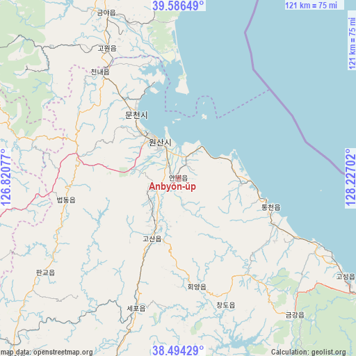
Anbyŏn-ŭp GPS coordinates[2]
39° 2' 33" North, 127° 31' 26.004" East
| Map corner | latitude | longitude |
|---|---|---|
| Upper-left | 39.58649°, | 126.82077° |
| Center: | 39.0425°, | 127.52389° |
| Lower-right: | 38.49429°, | 128.22702° |
| Map W x H: | 121.4×121.4 km | = 75.4×75.4mi |
| max Lat: | 42.95722° ⇑74.7% North |
| Anbyŏn-ŭp: | 39.0425° |
| min Lat: | ⇓25.3% South 37.90889° |
| min Long | Anbyŏn-ŭp | max Long |
| 124.39806° | 127.52389° | 130.49522° |
| W 53.8%⇐ | ⇒46.2% E |
Elevation
Elevation of Anbyŏn-ŭp is 17 m = 56 ft, and this is 114.7 m = 376 ft below average elevation for this country.
| Max E: |
1466 m = 4810 ft | 76.9% |
| Avg. | 131.7 m = 432 ft | |
| Anbyŏn-ŭp | 17 m = 56 ft | |
Min E: |
1 m = 3 ft | 23.1% |
See also: North Korea elevation on elevation.city.
Geographical zone
Anbyŏn-ŭp is located in North temperate zone (between Tropic of Cancer and the Arctic Circle). Distance of this Northern Tropic circle is 1735.2 km =1078.2 mi to South.| Distance of | km | miles | from Anbyŏn-ŭp |
|---|---|---|---|
| North Pole | 5665.9 | 3520.6 | to North |
| Arctic Circle | 3060.1 | 1901.5 | to North |
| Tropic Cancer | 1735.2 | 1078.2 | to South |
| Equator | 4341.1 | 2697.4 | to South |


Nearby cities:
15 places around Anbyŏn-ŭp: (largest is in red/bold)
• Hamhŭng
97.4 km =60.5 mi,  0°
0°
• Hoeyang
37.5 km =23.3 mi,  170°
170°
• Hongwŏn
115.4 km =71.7 mi,  18°
18°
• Hŭngnam
88.1 km =54.7 mi,  5°
5°
• Kangdong-ŭp
123.7 km =76.9 mi,  275°
275°
• Koksan
79.6 km =49.5 mi,  248°
248°
• Kosan
22.7 km =14.1 mi,  203°
203°
• Kowŏn-ŭp
50.2 km =31.2 mi,  331°
331°
• Samho-rodongjagu
104.9 km =65.2 mi, 16°
• Sangsŏng-ni
56.9 km =35.4 mi, 284°
• Sinsang-ni
68.3 km =42.4 mi,  351°
351°
• T’ongch’ŏn-ŭp
33.3 km =20.7 mi,  107°
107°
• Wŏnsan
14.1 km =8.8 mi, 330°
• Yuktae-dong
122.1 km =75.9 mi,  26°
26°
• Yŏnggwang-ŭp
108.7 km =67.5 mi,  356°
356°
Sources, notices
• [Note1] Compared only with cities in North Korea existing in our database
• [Src1] Map data: © OpenStreetMap contributors (CC-BY-SA)
• [Src2] Other city data from geonames.org with taken over terms of usage.
• [Src3] Geographical zone / Annual Mean Temperature by Robert A. Rohde @ Wikipedia
