Sunch’ŏn geodata
Sunch’ŏn (South Pyongan) is a seat of a third-order administrative division; located in North Korea in Asia/Pyongyang (GMT+9) time zone. With population of 437,000 people, there are 3 cities with bigger population in this country. Compared to other cities in North Korea, 68.1% of cities are located further ↑North; 67% of cities are located further →East and 60.4% of cities have lower elevation than Sunch’ŏn. Note1


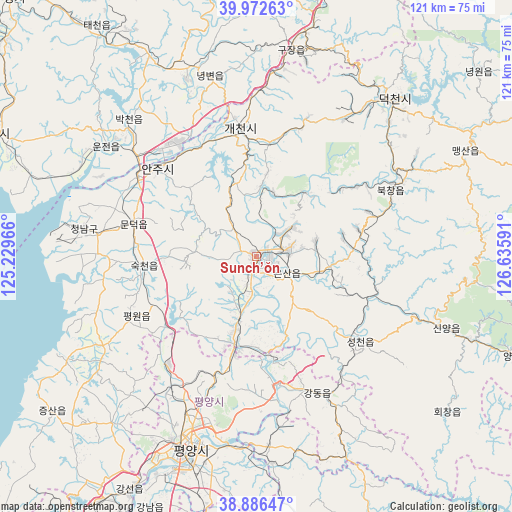
Sunch’ŏn GPS coordinates[2]
39° 25' 54.012" North, 125° 55' 58.008" East
| Map corner | latitude | longitude |
|---|---|---|
| Upper-left | 39.97263°, | 125.22966° |
| Center: | 39.43167°, | 125.93278° |
| Lower-right: | 38.88647°, | 126.63591° |
| Map W x H: | 120.8×120.8 km | = 75.1×75.1mi |
| max Lat: | 42.95722° ⇑68.1% North |
| Sunch’ŏn: | 39.43167° |
| min Lat: | ⇓31.9% South 37.90889° |
| min Long | Sunch’ŏn | max Long |
| 124.39806° | 125.93278° | 130.49522° |
| W 33%⇐ | ⇒67% E |
Elevation
Elevation of Sunch’ŏn is 72 m = 236 ft, and this is 59.7 m = 196 ft below average elevation for this country.
| Max E: |
1466 m = 4810 ft | 39.6% |
| Avg. | 131.7 m = 432 ft | |
| Sunch’ŏn | 72 m = 236 ft | |
Min E: |
1 m = 3 ft | 60.4% |
See also: Sunch’ŏn elevation on elevation.city.
Geographical zone
Sunch’ŏn is located in North temperate zone (between Tropic of Cancer and the Arctic Circle). Distance of this Northern Tropic circle is 1778.5 km =1105.1 mi to South.| Distance of | km | miles | from Sunch’ŏn |
|---|---|---|---|
| North Pole | 5622.7 | 3493.8 | to North |
| Arctic Circle | 3016.8 | 1874.6 | to North |
| Tropic Cancer | 1778.5 | 1105.1 | to South |
| Equator | 4384.4 | 2724.3 | to South |


Nearby cities:
15 places around Sunch’ŏn: (largest is in red/bold)
• Anju
30.9 km =19.2 mi,  311°
311°
• Chunghwa
64.2 km =39.9 mi,  190°
190°
• Chŏngju
68.4 km =42.5 mi,  295°
295°
• Hŭkkyo-ri
71.4 km =44.4 mi, 189°
• Kangdong-ŭp
35.1 km =21.8 mi,  156°
156°
• Kujang-ŭp
49.1 km =30.5 mi,  9°
9°
• Panghyŏn-dong
77.9 km =48.4 mi, 310°
• Pyongyang
46.8 km =29.1 mi,  199°
199°
• P’yŏngsŏng
21.3 km =13.2 mi, 194°
• Sil-li
40 km =24.9 mi,  280°
280°
• Sinanju
33.3 km =20.7 mi, 303°
• Sunan
33.3 km =20.7 mi,  218°
218°
• Sŭngho 1-tong
49.1 km =30.5 mi,  175°
175°
• Yonggang-ŭp
77.6 km =48.2 mi,  214°
214°
• Yŏngbyŏn
43.8 km =27.2 mi,  345°
345°
Sources, notices
• [Note1] Compared only with cities in North Korea existing in our database
• [Src1] Map data: © OpenStreetMap contributors (CC-BY-SA)
• [Src2] Other city data from geonames.org with taken over terms of usage.
• [Src3] Geographical zone / Annual Mean Temperature by Robert A. Rohde @ Wikipedia
