Kaesŏng geodata
Kaesŏng (Hwanghae-namdo) is a seat of a second-order administrative division; located in North Korea in Asia/Pyongyang (GMT+9) time zone. With population of 338,155 people, there are 5 cities with bigger population in this country. Compared to other cities in North Korea, 97.8% of cities are located further ↑North; 57.1% of cities are located further →East and 50.5% of cities have higher elevation than Kaesŏng. Note1


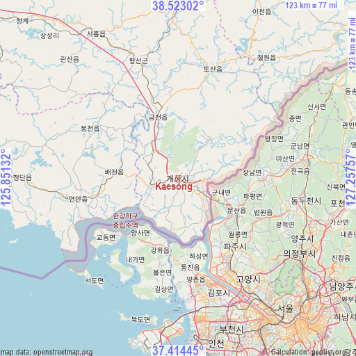
Kaesŏng GPS coordinates[2]
37° 58' 14.988" North, 126° 33' 15.984" East
| Map corner | latitude | longitude |
|---|---|---|
| Upper-left | 38.52302°, | 125.85132° |
| Center: | 37.97083°, | 126.55444° |
| Lower-right: | 37.41445°, | 127.25757° |
| Map W x H: | 123.3×123.3 km | = 76.6×76.6mi |
| max Lat: | 42.95722° ⇑97.8% North |
| Kaesŏng: | 37.97083° |
| min Lat: | ⇓2.2% South 37.90889° |
| min Long | Kaesŏng | max Long |
| 124.39806° | 126.55444° | 130.49522° |
| W 42.9%⇐ | ⇒57.1% E |
Elevation
Elevation of Kaesŏng is 42 m = 138 ft, and this is 89.7 m = 294 ft below average elevation for this country.
| Max E: |
1466 m = 4810 ft | 50.5% |
| Avg. | 131.7 m = 432 ft | |
| Kaesŏng | 42 m = 138 ft | |
Min E: |
1 m = 3 ft | 49.5% |
See also: Kaesŏng elevation on elevation.city.
Geographical zone
Kaesŏng is located in North temperate zone (between Tropic of Cancer and the Arctic Circle). Distance of this Northern Tropic circle is 1616 km =1004.1 mi to South.| Distance of | km | miles | from Kaesŏng |
|---|---|---|---|
| North Pole | 5785.1 | 3594.7 | to North |
| Arctic Circle | 3179.2 | 1975.5 | to North |
| Tropic Cancer | 1616 | 1004.1 | to South |
| Equator | 4222 | 2623.4 | to South |


Nearby cities:
15 places around Kaesŏng: (largest is in red/bold)
• Anak
110.4 km =68.6 mi,  302°
302°
• Ayang-ni
74.2 km =46.1 mi,  294°
294°
• Chaeryŏng-ŭp
94.9 km =59 mi, 300°
• Chunghwa
119.1 km =74 mi,  326°
326°
• Haeju
74 km =46 mi,  276°
276°
• Hoeyang
122.7 km =76.2 mi,  47°
47°
• Hwangju-ŭp
103.2 km =64.1 mi,  318°
318°
• Hŭkkyo-ri
113.5 km =70.5 mi, 324°
• Koksan
90.7 km =56.4 mi,  6°
6°
• Ongjin
104.6 km =65 mi,  267°
267°
• Pyŏksŏng-ŭp
87.8 km =54.6 mi, 275°
• Sariwŏn
91.8 km =57 mi,  310°
310°
• Sinmak
57 km =35.4 mi, 330°
• Songnim
117.8 km =73.2 mi, 317°
• Yŏnan-ŭp
35.2 km =21.9 mi,  258°
258°
Sources, notices
• [Note1] Compared only with cities in North Korea existing in our database
• [Src1] Map data: © OpenStreetMap contributors (CC-BY-SA)
• [Src2] Other city data from geonames.org with taken over terms of usage.
• [Src3] Geographical zone / Annual Mean Temperature by Robert A. Rohde @ Wikipedia
