Koesan geodata
Koesan (North Chungcheong) is a populated place; located in South Korea in Asia/Seoul (GMT+9) time zone. With population of 44,461 people, there are 87 cities with bigger population in this country. Compared to other cities in South Korea, 71.3% of cities are located further ↓South; 74.8% of cities are located further ←West and 83.2% of cities have lower elevation than Koesan. Note1


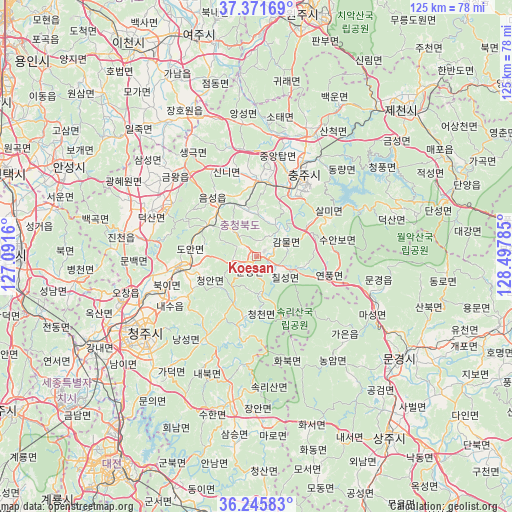
Koesan GPS coordinates[2]
36° 48' 38.988" North, 127° 47' 40.992" East
| Map corner | latitude | longitude |
|---|---|---|
| Upper-left | 37.37169°, | 127.0916° |
| Center: | 36.81083°, | 127.79472° |
| Lower-right: | 36.24583°, | 128.49785° |
| Map W x H: | 125.2×125.2 km | = 77.8×77.8mi |
| max Lat: | 38.37881° ⇑28.7% North |
| Koesan: | 36.81083° |
| min Lat: | ⇓71.3% South 33.25333° |
| min Long | Koesan | max Long |
| 126.10863° | 127.79472° | 129.55377° |
| W 74.8%⇐ | ⇒25.2% E |
Elevation
Elevation of Koesan is 116 m = 381 ft, and this is 45.6 m = 150 ft above average elevation for this country.
| Max E: |
691 m = 2267 ft | 16.8% |
| Koesan | 116 m 381 ft | |
| Avg. | 70.4 m = 231 ft | |
Min E: |
1 m = 3 ft | 83.2% |
See also: Koesan elevation on elevation.city.
Geographical zone
Koesan is located in North temperate zone (between Tropic of Cancer and the Arctic Circle). Distance of this Northern Tropic circle is 1487.1 km =924 mi to South.| Distance of | km | miles | from Koesan |
|---|---|---|---|
| North Pole | 5914.1 | 3674.9 | to North |
| Arctic Circle | 3308.2 | 2055.6 | to North |
| Tropic Cancer | 1487.1 | 924 | to South |
| Equator | 4093 | 2543.3 | to South |


Nearby cities:
15 places around Koesan: (largest is in red/bold)
• Annae
47.8 km =29.7 mi,  194°
194°
• Annam
51.6 km =32.1 mi, 192°
• Anseong
51.7 km =32.1 mi,  295°
295°
• Cheongju-si
33.3 km =20.7 mi,  234°
234°
• Cheongsan
51.6 km =32.1 mi,  180°
180°
• Cheongseong
53.9 km =33.5 mi, 183°
• Chinch'ŏn
31.7 km =19.7 mi,  279°
279°
• Hoenam
45 km =28 mi,  205°
205°
• Hwanam
41.5 km =25.8 mi,  166°
166°
• Mungyeong
29.2 km =18.1 mi,  106°
106°
• Mungyeong
43.4 km =27 mi,  123°
123°
• Samseung
46.4 km =28.8 mi, 186°
• Sangju
54.8 km =34.1 mi,  143°
143°
• Sejong
51 km =31.7 mi,  241°
241°
• Sintansin
51.3 km =31.9 mi,  219°
219°
Sources, notices
• [Note1] Compared only with cities in South Korea existing in our database
• [Src1] Map data: © OpenStreetMap contributors (CC-BY-SA)
• [Src2] Other city data from geonames.org with taken over terms of usage.
• [Src3] Geographical zone / Annual Mean Temperature by Robert A. Rohde @ Wikipedia
