Chinch'ŏn geodata
Chinch'ŏn (North Chungcheong) is a populated place; located in South Korea in Asia/Seoul (GMT+9) time zone. With population of 60,964 people, there are 75 cities with bigger population in this country. Compared to other cities in South Korea, 72% of cities are located further ↓South; 57.7% of cities are located further ←West and 66.1% of cities have lower elevation than Chinch'ŏn. Note1


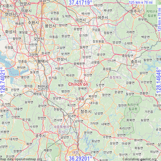
Chinch'ŏn GPS coordinates[2]
36° 51' 24.012" North, 127° 26' 35.988" East
| Map corner | latitude | longitude |
|---|---|---|
| Upper-left | 37.41719°, | 126.74021° |
| Center: | 36.85667°, | 127.44333° |
| Lower-right: | 36.29201°, | 128.14646° |
| Map W x H: | 125.1×125.1 km | = 77.7×77.7mi |
| max Lat: | 38.37881° ⇑28% North |
| Chinch'ŏn: | 36.85667° |
| min Lat: | ⇓72% South 33.25333° |
| min Long | Chinch'ŏn | max Long |
| 126.10863° | 127.44333° | 129.55377° |
| W 57.7%⇐ | ⇒42.3% E |
Elevation
Elevation of Chinch'ŏn is 69 m = 226 ft, and this is 1.4 m = 5 ft below average elevation for this country.
| Max E: |
691 m = 2267 ft | 33.9% |
| Avg. | 70.4 m = 231 ft | |
| Chinch'ŏn | 69 m = 226 ft | |
Min E: |
1 m = 3 ft | 66.1% |
See also: Chinch'ŏn elevation on elevation.city.
Geographical zone
Chinch'ŏn is located in North temperate zone (between Tropic of Cancer and the Arctic Circle). Distance of this Northern Tropic circle is 1492.2 km =927.2 mi to South.| Distance of | km | miles | from Chinch'ŏn |
|---|---|---|---|
| North Pole | 5909 | 3671.7 | to North |
| Arctic Circle | 3303.1 | 2052.5 | to North |
| Tropic Cancer | 1492.2 | 927.2 | to South |
| Equator | 4098.1 | 2546.4 | to South |


Nearby cities:
15 places around Chinch'ŏn: (largest is in red/bold)
• Anseong
23 km =14.3 mi,  318°
318°
• Asan
39.9 km =24.8 mi,  258°
258°
• Cheonan
26.5 km =16.5 mi, 257°
• Cheongju-si
24.7 km =15.3 mi,  170°
170°
• Gongju
52.9 km =32.9 mi,  212°
212°
• Hoenam
47.4 km =29.5 mi, 165°
• Icheon-si
47 km =29.2 mi,  359°
359°
• Koesan
31.7 km =19.7 mi,  99°
99°
• Osan
46.6 km =29 mi,  314°
314°
• Pubal
48.7 km =30.3 mi,  6°
6°
• Sejong
32.3 km =20.1 mi,  204°
204°
• Seonghwan
28.5 km =17.7 mi,  283°
283°
• Sintansin
44.8 km =27.8 mi,  181°
181°
• Songgangdong
47.4 km =29.5 mi,  187°
187°
• Yeoju
51.7 km =32.1 mi,  19°
19°
Sources, notices
• [Note1] Compared only with cities in South Korea existing in our database
• [Src1] Map data: © OpenStreetMap contributors (CC-BY-SA)
• [Src2] Other city data from geonames.org with taken over terms of usage.
• [Src3] Geographical zone / Annual Mean Temperature by Robert A. Rohde @ Wikipedia
