Cheongju-si geodata
Cheongju-si (North Chungcheong) is a seat of a first-order administrative division; located in South Korea in Asia/Seoul (GMT+9) time zone. With population of 634,596 people, there are 13 cities with bigger population in this country. Compared to other cities in South Korea, 68.9% of cities are located further ↓South; 59.8% of cities are located further ←West and 55.9% of cities have lower elevation than Cheongju-si. Note1


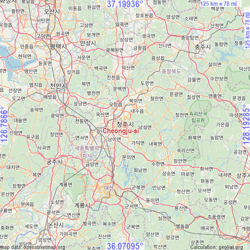
Cheongju-si GPS coordinates[2]
36° 38' 13.992" North, 127° 29' 22.992" East
| Map corner | latitude | longitude |
|---|---|---|
| Upper-left | 37.19936°, | 126.7866° |
| Center: | 36.63722°, | 127.48972° |
| Lower-right: | 36.07095°, | 128.19285° |
| Map W x H: | 125.5×125.5 km | = 78×78mi |
| max Lat: | 38.37881° ⇑31.1% North |
| Cheongju-si: | 36.63722° |
| min Lat: | ⇓68.9% South 33.25333° |
| min Long | Cheongju-si | max Long |
| 126.10863° | 127.48972° | 129.55377° |
| W 59.8%⇐ | ⇒40.2% E |
Elevation
Elevation of Cheongju-si is 49 m = 161 ft, and this is 21.4 m = 70 ft below average elevation for this country.
| Max E: |
691 m = 2267 ft | 44.1% |
| Avg. | 70.4 m = 231 ft | |
| Cheongju-si | 49 m = 161 ft | |
Min E: |
1 m = 3 ft | 55.9% |
See also: Cheongju-si elevation on elevation.city.
Geographical zone
Cheongju-si is located in North temperate zone (between Tropic of Cancer and the Arctic Circle). Distance of this Northern Tropic circle is 1467.8 km =912 mi to South.| Distance of | km | miles | from Cheongju-si |
|---|---|---|---|
| North Pole | 5933.4 | 3686.8 | to North |
| Arctic Circle | 3327.5 | 2067.6 | to North |
| Tropic Cancer | 1467.8 | 912 | to South |
| Equator | 4073.7 | 2531.3 | to South |


Nearby cities:
15 places around Cheongju-si: (largest is in red/bold)
• Annae
31 km =19.3 mi,  150°
150°
• Annam
35.2 km =21.9 mi, 152°
• Cheonan
35.5 km =22.1 mi,  302°
302°
• Chinch'ŏn
24.7 km =15.3 mi,  350°
350°
• Daejeon
33.4 km =20.8 mi,  196°
196°
• Gongju
38.4 km =23.9 mi,  238°
238°
• Gunbuk
34.3 km =21.3 mi,  173°
173°
• Hoenam
22.9 km =14.2 mi,  159°
159°
• Koesan
33.3 km =20.7 mi,  54°
54°
• Okcheon
38 km =23.6 mi, 169°
• Samseung
34.4 km =21.4 mi,  140°
140°
• Sejong
18.3 km =11.4 mi,  254°
254°
• Sintansin
21.1 km =13.1 mi,  194°
194°
• Songgangdong
24.8 km =15.4 mi, 204°
• Yuseong
34.3 km =21.3 mi, 203°
Sources, notices
• [Note1] Compared only with cities in South Korea existing in our database
• [Src1] Map data: © OpenStreetMap contributors (CC-BY-SA)
• [Src2] Other city data from geonames.org with taken over terms of usage.
• [Src3] Geographical zone / Annual Mean Temperature by Robert A. Rohde @ Wikipedia
