Yesan geodata
Yesan (Chungcheongnam-do) is a populated place; located in South Korea in Asia/Seoul (GMT+9) time zone. With population of 39,409 people, there are 95 cities with bigger population in this country. Compared to other cities in South Korea, 69.6% of cities are located further ↓South; 74.5% of cities are located further →East and 67.5% of cities have higher elevation than Yesan. Note1


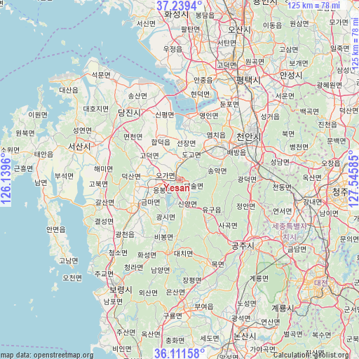
Yesan GPS coordinates[2]
36° 40' 39.216" North, 126° 50' 33.792" East
| Map corner | latitude | longitude |
|---|---|---|
| Upper-left | 37.2394°, | 126.1396° |
| Center: | 36.67756°, | 126.84272° |
| Lower-right: | 36.11158°, | 127.54585° |
| Map W x H: | 125.4×125.4 km | = 77.9×77.9mi |
| max Lat: | 38.37881° ⇑30.4% North |
| Yesan: | 36.67756° |
| min Lat: | ⇓69.6% South 33.25333° |
| min Long | Yesan | max Long |
| 126.10863° | 126.84272° | 129.55377° |
| W 25.5%⇐ | ⇒74.5% E |
Elevation
Elevation of Yesan is 23 m = 75 ft, and this is 47.4 m = 156 ft below average elevation for this country.
| Max E: |
691 m = 2267 ft | 67.5% |
| Avg. | 70.4 m = 231 ft | |
| Yesan | 23 m = 75 ft | |
Min E: |
1 m = 3 ft | 32.5% |
See also: South Korea elevation on elevation.city.
Geographical zone
Yesan is located in North temperate zone (between Tropic of Cancer and the Arctic Circle). Distance of this Northern Tropic circle is 1472.2 km =914.8 mi to South.| Distance of | km | miles | from Yesan |
|---|---|---|---|
| North Pole | 5928.9 | 3684 | to North |
| Arctic Circle | 3323 | 2064.8 | to North |
| Tropic Cancer | 1472.2 | 914.8 | to South |
| Equator | 4078.2 | 2534.1 | to South |


Nearby cities:
15 places around Yesan: (largest is in red/bold)
• Asan
18.6 km =11.6 mi,  50°
50°
• Boryeong
42.6 km =26.5 mi,  210°
210°
• Buyeo
45.2 km =28.1 mi,  172°
172°
• Cheonan
31.1 km =19.3 mi,  62°
62°
• Cheongnam
37.4 km =23.2 mi,  164°
164°
• Cheongyang
25.4 km =15.8 mi,  187°
187°
• Gongju
35.3 km =21.9 mi,  134°
134°
• Gyuam
44.9 km =27.9 mi,  175°
175°
• Hongseong
18 km =11.2 mi,  241°
241°
• Jangpyeong
37.6 km =23.4 mi, 173°
• Sejong
41.2 km =25.6 mi,  103°
103°
• Seonghwan
36.9 km =22.9 mi,  44°
44°
• Seosan
36.7 km =22.8 mi,  288°
288°
• Taesal-li
47.6 km =29.6 mi,  313°
313°
• Tangjin
30.7 km =19.1 mi,  321°
321°
Sources, notices
• [Note1] Compared only with cities in South Korea existing in our database
• [Src1] Map data: © OpenStreetMap contributors (CC-BY-SA)
• [Src2] Other city data from geonames.org with taken over terms of usage.
• [Src3] Geographical zone / Annual Mean Temperature by Robert A. Rohde @ Wikipedia
