Cheonan geodata
Cheonan (Chungcheongnam-do) is a populated place; located in South Korea in Asia/Seoul (GMT+9) time zone. With population of 365,114 people, there are 21 cities with bigger population in this country. Compared to other cities in South Korea, 71% of cities are located further ↓South; 55.2% of cities are located further →East and 50.7% of cities have higher elevation than Cheonan. Note1


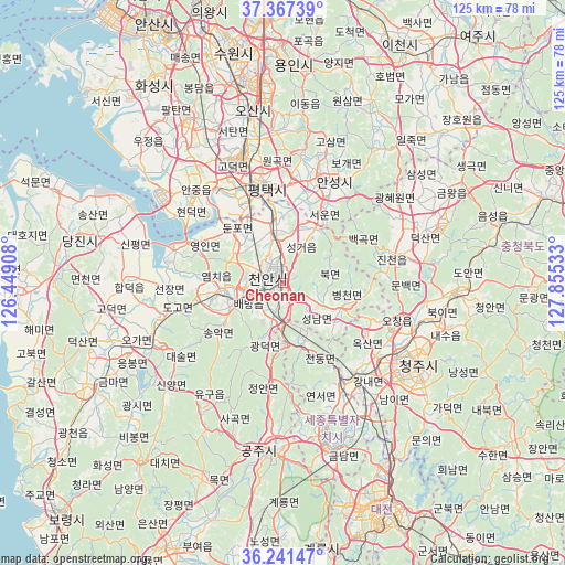
Cheonan GPS coordinates[2]
36° 48' 23.4" North, 127° 9' 7.92" East
| Map corner | latitude | longitude |
|---|---|---|
| Upper-left | 37.36739°, | 126.44908° |
| Center: | 36.8065°, | 127.1522° |
| Lower-right: | 36.24147°, | 127.85533° |
| Map W x H: | 125.2×125.2 km | = 77.8×77.8mi |
| max Lat: | 38.37881° ⇑29% North |
| Cheonan: | 36.8065° |
| min Lat: | ⇓71% South 33.25333° |
| min Long | Cheonan | max Long |
| 126.10863° | 127.1522° | 129.55377° |
| W 44.8%⇐ | ⇒55.2% E |
Elevation
Elevation of Cheonan is 40 m = 131 ft, and this is 30.4 m = 100 ft below average elevation for this country.
| Max E: |
691 m = 2267 ft | 50.7% |
| Avg. | 70.4 m = 231 ft | |
| Cheonan | 40 m = 131 ft | |
Min E: |
1 m = 3 ft | 49.3% |
See also: Cheonan elevation on elevation.city.
Geographical zone
Cheonan is located in North temperate zone (between Tropic of Cancer and the Arctic Circle). Distance of this Northern Tropic circle is 1486.6 km =923.7 mi to South.| Distance of | km | miles | from Cheonan |
|---|---|---|---|
| North Pole | 5914.6 | 3675.2 | to North |
| Arctic Circle | 3308.7 | 2055.9 | to North |
| Tropic Cancer | 1486.6 | 923.7 | to South |
| Equator | 4092.5 | 2543 | to South |


Nearby cities:
15 places around Cheonan: (largest is in red/bold)
• Anseong
25 km =15.5 mi,  24°
24°
• Asan
13.4 km =8.3 mi,  259°
259°
• Cheongju-si
35.5 km =22.1 mi,  122°
122°
• Cheongyang
50.2 km =31.2 mi,  218°
218°
• Chinch'ŏn
26.5 km =16.5 mi,  77°
77°
• Gongju
39.1 km =24.3 mi,  183°
183°
• Hongseong
49.1 km =30.5 mi,  242°
242°
• Osan
39.1 km =24.3 mi,  349°
349°
• Sejong
26.9 km =16.7 mi,  152°
152°
• Seonghwan
12.3 km =7.6 mi, 351°
• Sintansin
46.5 km =28.9 mi, 147°
• Songgangdong
46 km =28.6 mi, 154°
• Tangjin
47.5 km =29.5 mi,  281°
281°
• Yesan
31.1 km =19.3 mi, 242°
• Yuseong
53 km =32.9 mi,  161°
161°
Sources, notices
• [Note1] Compared only with cities in South Korea existing in our database
• [Src1] Map data: © OpenStreetMap contributors (CC-BY-SA)
• [Src2] Other city data from geonames.org with taken over terms of usage.
• [Src3] Geographical zone / Annual Mean Temperature by Robert A. Rohde @ Wikipedia
