Kīevka geodata
Kīevka (Karaganda) is a populated place; located in Kazakhstan in Asia/Almaty (GMT+5) time zone. With population of 7,037 people, there are 153 cities with bigger population in this country. Compared to other cities in Kazakhstan, 69.3% of cities are located further ↓South; 55.2% of cities are located further ←West and 61.1% of cities have lower elevation than Kīevka. Note1


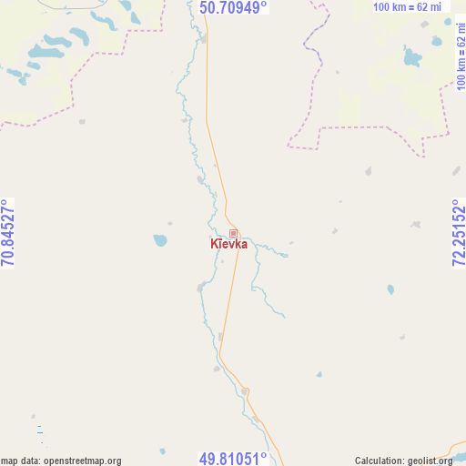
Kīevka GPS coordinates[2]
50° 15' 43.632" North, 71° 32' 54.204" East
| Map corner | latitude | longitude |
|---|---|---|
| Upper-left | 50.70949°, | 70.84527° |
| Center: | 50.26212°, | 71.54839° |
| Lower-right: | 49.81051°, | 72.25152° |
| Map W x H: | 100×100 km | = 62.1×62.1mi |
| max Lat: | 54.90596° ⇑30.7% North |
| Kīevka: | 50.26212° |
| min Lat: | ⇓69.3% South 40.66338° |
| min Long | Kīevka | max Long |
| 46.83361° | 71.54839° | 84.87144° |
| W 55.2%⇐ | ⇒44.8% E |
Elevation
Elevation of Kīevka is 397 m = 1302 ft, and this is 40.5 m = 133 ft above average elevation for this country.
| Max E: |
1847 m = 6060 ft | 38.9% |
| Kīevka | 397 m 1302 ft | |
| Avg. | 356.5 m = 1170 ft | |
Min E: |
-26 m = -85 ft | 61.1% |
See also: Kazakhstan elevation on elevation.city.
Geographical zone
Kīevka is located in North temperate zone (between Tropic of Cancer and the Arctic Circle). Distance of this North polar circle is 1812.6 km =1126.3 mi to North.| Distance of | km | miles | from Kīevka |
|---|---|---|---|
| North Pole | 4418.4 | 2745.5 | to North |
| Arctic Circle | 1812.6 | 1126.3 | to North |
| Tropic Cancer | 2982.7 | 1853.4 | to South |
| Equator | 5588.6 | 3472.6 | to South |


Nearby cities:
15 places around Kīevka: (largest is in red/bold)
• Abay
117 km =72.7 mi,  126°
126°
• Aktas
114.3 km =71 mi,  117°
117°
• Aktau
108 km =67.1 mi,  91°
91°
• Dolinka
103.7 km =64.4 mi, 128°
• Karagandy
122.2 km =75.9 mi,  114°
114°
• Kushoky
131.8 km =81.9 mi, 91°
• Kyzylzhar
81.7 km =50.8 mi, 112°
• Novodolinskiy
103.4 km =64.2 mi, 126°
• Nur-Sultan
102.3 km =63.6 mi,  355°
355°
• Osakarovka
79.8 km =49.6 mi,  65°
65°
• Shakhan
93 km =57.8 mi, 121°
• Shakhtinsk
96.7 km =60.1 mi, 129°
• Soran
105.9 km =65.8 mi, 119°
• Temirtau
103.5 km =64.3 mi,  102°
102°
• Tokarevka
115.9 km =72 mi, 98°
Sources, notices
• [Note1] Compared only with cities in Kazakhstan existing in our database
• [Src1] Map data: © OpenStreetMap contributors (CC-BY-SA)
• [Src2] Other city data from geonames.org with taken over terms of usage.
• [Src3] Geographical zone / Annual Mean Temperature by Robert A. Rohde @ Wikipedia
