Ban Houakhoua geodata
Ban Houakhoua (Bokeo) is a populated place; located in Laos in Asia/Vientiane (GMT+7) time zone. With population of 15,500 people, there are 10 cities with bigger population in this country. Compared to other cities in Laos, 73.1% of cities are located further ↓South; 98.1% of cities are located further →East and 53.8% of cities have lower elevation than Ban Houakhoua. Note1


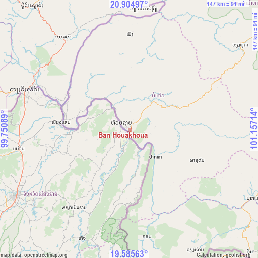
Ban Houakhoua GPS coordinates[2]
20° 14' 48.12" North, 100° 27' 14.436" East
| Map corner | latitude | longitude |
|---|---|---|
| Upper-left | 20.90497°, | 99.75089° |
| Center: | 20.2467°, | 100.45401° |
| Lower-right: | 19.58563°, | 101.15714° |
| Map W x H: | 146.7×146.7 km | = 91.2×91.2mi |
| max Lat: | 21.6808° ⇑26.9% North |
| Ban Houakhoua: | 20.2467° |
| min Lat: | ⇓73.1% South 14.11785° |
| min Long | Ban Houakhoua | max Long |
| 100.4178° | 100.45401° | 107.26667° |
| W 1.9%⇐ | ⇒98.1% E |
Elevation
Elevation of Ban Houakhoua is 361 m = 1184 ft, and this is 112.6 m = 369 ft below average elevation for this country.
| Max E: |
1722 m = 5650 ft | 46.2% |
| Avg. | 473.6 m = 1554 ft | |
| Ban Houakhoua | 361 m = 1184 ft | |
Min E: |
83 m = 272 ft | 53.8% |
See also: Laos elevation on elevation.city.
Geographical zone
Ban Houakhoua is located in North Torrid zone (between Equator and Tropic of Cancer). Distance of this Northern Tropic circle is 354.7 km =220.4 mi to North.| Distance of | km | miles | from Ban Houakhoua |
|---|---|---|---|
| North Pole | 7755.8 | 4819.2 | to North |
| Arctic Circle | 5150 | 3200.1 | to North |
| Tropic Cancer | 354.7 | 220.4 | to North |
| Equator | 2251.2 | 1398.8 | to South |


Nearby cities:
15 places around Ban Houakhoua: (largest is in red/bold)
• Ban Houayxay
4.6 km =2.9 mi,  304°
304°
• Ban Namnga
257.7 km =160.1 mi,  66°
66°
• Ban Pakla
185.9 km =115.5 mi, 68°
• Ban Xiang-Ngeun
188.6 km =117.2 mi,  106°
106°
• Khoa
232.7 km =144.6 mi, 66°
• Luang Namtha
125.8 km =78.2 mi,  51°
51°
• Luang Prabang
180.1 km =111.9 mi,  102°
102°
• Muang Kasi
219.7 km =136.5 mi,  120°
120°
• Muang Long
88.5 km =55 mi,  25°
25°
• Muang Nalè
108.2 km =67.2 mi, 72°
• Muang Sing
127.5 km =79.2 mi, 34°
• Muang Xay
166.9 km =103.7 mi, 72°
• Phôngsali
233.8 km =145.3 mi, 46°
• Sainyabuli
171.4 km =106.5 mi,  129°
129°
• Vangviang
255.5 km =158.8 mi, 125°
Sources, notices
• [Note1] Compared only with cities in Laos existing in our database
• [Src1] Map data: © OpenStreetMap contributors (CC-BY-SA)
• [Src2] Other city data from geonames.org with taken over terms of usage.
• [Src3] Geographical zone / Annual Mean Temperature by Robert A. Rohde @ Wikipedia
