Muang Xay geodata
Muang Xay (Oudômxai) is a seat of a first-order administrative division; located in Laos in Asia/Vientiane (GMT+7) time zone. With population of 25,000 people, there are 7 cities with bigger population in this country. Compared to other cities in Laos, 86.5% of cities are located further ↓South; 82.7% of cities are located further →East and 75% of cities have lower elevation than Muang Xay. Note1


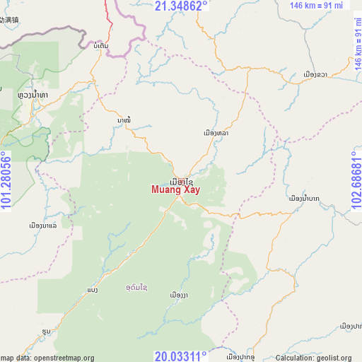
Muang Xay GPS coordinates[2]
20° 41' 32.244" North, 101° 59' 1.248" East
| Map corner | latitude | longitude |
|---|---|---|
| Upper-left | 21.34862°, | 101.28056° |
| Center: | 20.69229°, | 101.98368° |
| Lower-right: | 20.03311°, | 102.68681° |
| Map W x H: | 146.3×146.3 km | = 90.9×90.9mi |
| max Lat: | 21.6808° ⇑13.5% North |
| Muang Xay: | 20.69229° |
| min Lat: | ⇓86.5% South 14.11785° |
| min Long | Muang Xay | max Long |
| 100.4178° | 101.98368° | 107.26667° |
| W 17.3%⇐ | ⇒82.7% E |
Elevation
Elevation of Muang Xay is 652 m = 2139 ft, and this is 178.4 m = 585 ft above average elevation for this country.
| Max E: |
1722 m = 5650 ft | 25% |
| Muang Xay | 652 m 2139 ft | |
| Avg. | 473.6 m = 1554 ft | |
Min E: |
83 m = 272 ft | 75% |
See also: Laos elevation on elevation.city.
Geographical zone
Muang Xay is located in North Torrid zone (between Equator and Tropic of Cancer). Distance of this Northern Tropic circle is 305.2 km =189.6 mi to North.| Distance of | km | miles | from Muang Xay |
|---|---|---|---|
| North Pole | 7706.3 | 4788.5 | to North |
| Arctic Circle | 5100.4 | 3169.2 | to North |
| Tropic Cancer | 305.2 | 189.6 | to North |
| Equator | 2300.8 | 1429.7 | to South |


Nearby cities:
15 places around Muang Xay: (largest is in red/bold)
• Ban Houakhoua
166.9 km =103.7 mi,  252°
252°
• Ban Houayxay
169.7 km =105.4 mi, 253°
• Ban Namnga
93.7 km =58.2 mi,  55°
55°
• Ban Pakla
23.8 km =14.8 mi,  34°
34°
• Ban Xiang-Ngeun
105.9 km =65.8 mi,  168°
168°
• Khoa
69.2 km =43 mi,  51°
51°
• Luang Namtha
66.8 km =41.5 mi,  295°
295°
• Luang Prabang
91 km =56.5 mi, 170°
• Muang Kasi
165.1 km =102.6 mi, 170°
• Muang Long
124.6 km =77.4 mi,  284°
284°
• Muang Nalè
58.6 km =36.4 mi, 252°
• Muang Sing
103.1 km =64.1 mi, 302°
• Phôngsali
110.6 km =68.7 mi,  6°
6°
• Sainyabuli
162.1 km =100.7 mi,  190°
190°
• Viengthong
153.8 km =95.6 mi,  105°
105°
Sources, notices
• [Note1] Compared only with cities in Laos existing in our database
• [Src1] Map data: © OpenStreetMap contributors (CC-BY-SA)
• [Src2] Other city data from geonames.org with taken over terms of usage.
• [Src3] Geographical zone / Annual Mean Temperature by Robert A. Rohde @ Wikipedia
