Vangviang geodata
Vangviang (Vientiane) is a populated place; located in Laos in Asia/Vientiane (GMT+7) time zone. With population of 25,000 people, there are 7 cities with bigger population in this country. Compared to other cities in Laos, 57.7% of cities are located further ↓South; 69.2% of cities are located further →East and 53.8% of cities have higher elevation than Vangviang. Note1


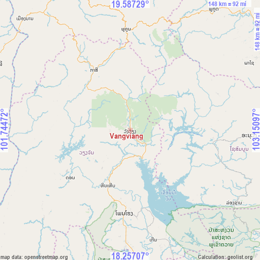
Vangviang GPS coordinates[2]
18° 55' 24.6" North, 102° 26' 52.224" East
| Map corner | latitude | longitude |
|---|---|---|
| Upper-left | 19.58729°, | 101.74472° |
| Center: | 18.9235°, | 102.44784° |
| Lower-right: | 18.25707°, | 103.15097° |
| Map W x H: | 147.9×147.9 km | = 91.9×91.9mi |
| max Lat: | 21.6808° ⇑42.3% North |
| Vangviang: | 18.9235° |
| min Lat: | ⇓57.7% South 14.11785° |
| min Long | Vangviang | max Long |
| 100.4178° | 102.44784° | 107.26667° |
| W 30.8%⇐ | ⇒69.2% E |
Elevation
Elevation of Vangviang is 243 m = 797 ft, and this is 230.6 m = 757 ft below average elevation for this country.
| Max E: |
1722 m = 5650 ft | 53.8% |
| Avg. | 473.6 m = 1554 ft | |
| Vangviang | 243 m = 797 ft | |
Min E: |
83 m = 272 ft | 46.2% |
See also: Laos elevation on elevation.city.
Geographical zone
Vangviang is located in North Torrid zone (between Equator and Tropic of Cancer). Distance of this Northern Tropic circle is 501.8 km =311.8 mi to North.| Distance of | km | miles | from Vangviang |
|---|---|---|---|
| North Pole | 7903 | 4910.7 | to North |
| Arctic Circle | 5297.1 | 3291.5 | to North |
| Tropic Cancer | 501.8 | 311.8 | to North |
| Equator | 2104.1 | 1307.4 | to South |


Nearby cities:
15 places around Vangviang: (largest is in red/bold)
• Ban Nahin
200.8 km =124.8 mi,  112°
112°
• Ban Xiang-Ngeun
96.9 km =60.2 mi,  343°
343°
• Borikhan
140.5 km =87.3 mi, 106°
• Luang Prabang
111.9 km =69.5 mi, 342°
• Muang Kasi
39.7 km =24.7 mi,  328°
328°
• Muang Kènthao
172.6 km =107.2 mi,  219°
219°
• Muang Mok
163.9 km =101.8 mi,  90°
90°
• Muang Phôn-Hông
47.7 km =29.6 mi,  184°
184°
• Muang Phônsavan
97.6 km =60.6 mi,  53°
53°
• Muang Sanakham
139.2 km =86.5 mi, 215°
• Pakkading
176 km =109.4 mi, 112°
• Pakxan
140.7 km =87.4 mi, 114°
• Sainyabuli
85.9 km =53.4 mi,  295°
295°
• Viengthong
185.8 km =115.5 mi,  32°
32°
• Vientiane
107.6 km =66.9 mi,  171°
171°
Sources, notices
• [Note1] Compared only with cities in Laos existing in our database
• [Src1] Map data: © OpenStreetMap contributors (CC-BY-SA)
• [Src2] Other city data from geonames.org with taken over terms of usage.
• [Src3] Geographical zone / Annual Mean Temperature by Robert A. Rohde @ Wikipedia
