Luang Prabang geodata
Luang Prabang (Louangphabang) is a seat of a first-order administrative division; located in Laos in Asia/Vientiane (GMT+7) time zone. With population of 47,378 people, there are 4 cities with bigger population in this country. Compared to other cities in Laos, 67.3% of cities are located further ↓South; 76.9% of cities are located further →East and 50% of cities have lower elevation than Luang Prabang. Note1


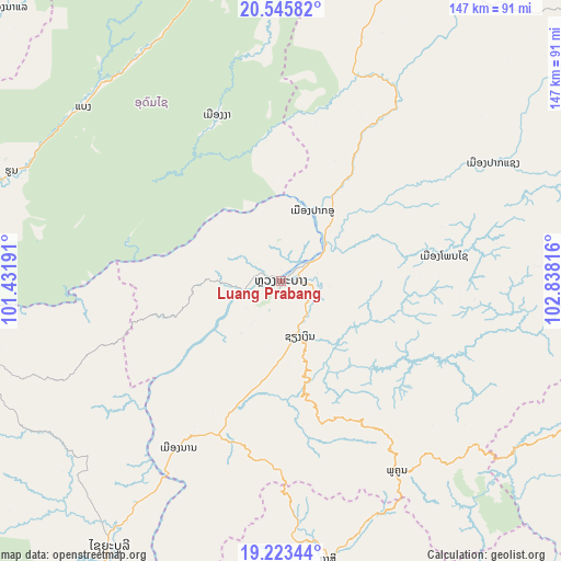
Luang Prabang GPS coordinates[2]
19° 53' 9.636" North, 102° 8' 6.108" East
| Map corner | latitude | longitude |
|---|---|---|
| Upper-left | 20.54582°, | 101.43191° |
| Center: | 19.88601°, | 102.13503° |
| Lower-right: | 19.22344°, | 102.83816° |
| Map W x H: | 147×147 km | = 91.3×91.3mi |
| max Lat: | 21.6808° ⇑32.7% North |
| Luang Prabang: | 19.88601° |
| min Lat: | ⇓67.3% South 14.11785° |
| min Long | Luang Prabang | max Long |
| 100.4178° | 102.13503° | 107.26667° |
| W 23.1%⇐ | ⇒76.9% E |
Elevation
Elevation of Luang Prabang is 300 m = 984 ft, and this is 173.6 m = 570 ft below average elevation for this country.
| Max E: |
1722 m = 5650 ft | 50% |
| Avg. | 473.6 m = 1554 ft | |
| Luang Prabang | 300 m = 984 ft | |
Min E: |
83 m = 272 ft | 50% |
See also: Luang Prabang elevation on elevation.city.
Geographical zone
Luang Prabang is located in North Torrid zone (between Equator and Tropic of Cancer). Distance of this Northern Tropic circle is 394.8 km =245.3 mi to North.| Distance of | km | miles | from Luang Prabang |
|---|---|---|---|
| North Pole | 7795.9 | 4844.1 | to North |
| Arctic Circle | 5190.1 | 3225 | to North |
| Tropic Cancer | 394.8 | 245.3 | to North |
| Equator | 2211.1 | 1373.9 | to South |


Nearby cities:
15 places around Luang Prabang: (largest is in red/bold)
• Ban Houakhoua
180.1 km =111.9 mi,  282°
282°
• Ban Namnga
155.6 km =96.7 mi,  23°
23°
• Ban Pakla
109.4 km =68 mi,  358°
358°
• Ban Xiang-Ngeun
15 km =9.3 mi,  160°
160°
• Khoa
138.1 km =85.8 mi, 16°
• Luang Namtha
140.7 km =87.4 mi,  327°
327°
• Muang Kasi
74.1 km =46 mi,  170°
170°
• Muang Nalè
101.6 km =63.1 mi,  315°
315°
• Muang Phôn-Hông
157.4 km =97.8 mi, 169°
• Muang Phônsavan
120.8 km =75.1 mi,  113°
113°
• Muang Sing
177.9 km =110.5 mi, 324°
• Muang Xay
91 km =56.5 mi,  350°
350°
• Sainyabuli
82.8 km =51.4 mi,  212°
212°
• Vangviang
111.9 km =69.5 mi, 162°
• Viengthong
141.8 km =88.1 mi,  69°
69°
Sources, notices
• [Note1] Compared only with cities in Laos existing in our database
• [Src1] Map data: © OpenStreetMap contributors (CC-BY-SA)
• [Src2] Other city data from geonames.org with taken over terms of usage.
• [Src3] Geographical zone / Annual Mean Temperature by Robert A. Rohde @ Wikipedia
