Viengthong geodata
Viengthong (Houaphan) is a seat of a second-order administrative division; located in Laos in Asia/Vientiane (GMT+7) time zone. In our database, there are 24 cities with bigger population. Compared to other cities in Laos, 76.9% of cities are located further ↓South; 59.6% of cities are located further →East and 94.2% of cities have lower elevation than Viengthong. Note1


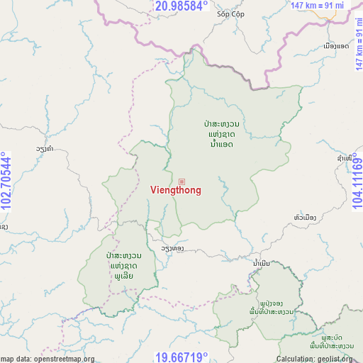
Viengthong GPS coordinates[2]
20° 19' 40.512" North, 103° 24' 30.816" East
| Map corner | latitude | longitude |
|---|---|---|
| Upper-left | 20.98584°, | 102.70544° |
| Center: | 20.32792°, | 103.40856° |
| Lower-right: | 19.66719°, | 104.11169° |
| Map W x H: | 146.6×146.6 km | = 91.1×91.1mi |
| max Lat: | 21.6808° ⇑23.1% North |
| Viengthong: | 20.32792° |
| min Lat: | ⇓76.9% South 14.11785° |
| min Long | Viengthong | max Long |
| 100.4178° | 103.40856° | 107.26667° |
| W 40.4%⇐ | ⇒59.6% E |
Elevation
Elevation of Viengthong is 1313 m = 4308 ft, and this is 839.4 m = 2754 ft above average elevation for this country.
| Max E: |
1722 m = 5650 ft | 5.8% |
| Viengthong | 1313 m 4308 ft | |
| Avg. | 473.6 m = 1554 ft | |
Min E: |
83 m = 272 ft | 94.2% |
See also: Laos elevation on elevation.city.
Geographical zone
Viengthong is located in North Torrid zone (between Equator and Tropic of Cancer). Distance of this Northern Tropic circle is 345.7 km =214.8 mi to North.| Distance of | km | miles | from Viengthong |
|---|---|---|---|
| North Pole | 7746.8 | 4813.6 | to North |
| Arctic Circle | 5140.9 | 3194.4 | to North |
| Tropic Cancer | 345.7 | 214.8 | to North |
| Equator | 2260.3 | 1404.5 | to South |


Nearby cities:
15 places around Viengthong: (largest is in red/bold)
• Ban Namnga
117.7 km =73.1 mi,  322°
322°
• Ban Pakla
147.8 km =91.8 mi,  294°
294°
• Ban Xiang-Ngeun
142.9 km =88.8 mi,  243°
243°
• Huameung
51 km =31.7 mi,  112°
112°
• Khoa
125.6 km =78 mi,  311°
311°
• Luang Prabang
141.8 km =88.1 mi,  249°
249°
• Muang Kasi
171.9 km =106.8 mi,  224°
224°
• Muang Mok
169.6 km =105.4 mi,  158°
158°
• Muang Phônsavan
100.3 km =62.3 mi,  193°
193°
• Muang Xay
153.8 km =95.6 mi, 285°
• Vangviang
185.8 km =115.5 mi,  212°
212°
• Viangxai
85.4 km =53.1 mi,  84°
84°
• Viengxay
97.6 km =60.6 mi,  89°
89°
• Xam Nua
67.1 km =41.7 mi, 81°
• Xamtay
123.3 km =76.6 mi, 110°
Sources, notices
• [Note1] Compared only with cities in Laos existing in our database
• [Src1] Map data: © OpenStreetMap contributors (CC-BY-SA)
• [Src2] Other city data from geonames.org with taken over terms of usage.
• [Src3] Geographical zone / Annual Mean Temperature by Robert A. Rohde @ Wikipedia
