Ra’s Bayrūt geodata
Ra’s Bayrūt (Beyrouth) is a section of populated place; located in Lebanon in Asia/Beirut (GMT+3) time zone. With population of 1,251,739 people, there is 1 city with bigger population in this country. Compared to other cities in Lebanon, 65.6% of cities are located further ↓South; 81.2% of cities are located further →East and 84.4% of cities have higher elevation than Ra’s Bayrūt. Note1


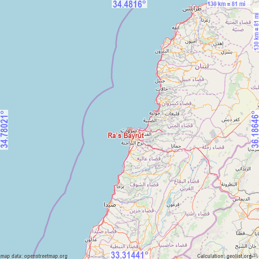
Ra’s Bayrūt GPS coordinates[2]
33° 54' 0" North, 35° 28' 59.988" East
| Map corner | latitude | longitude |
|---|---|---|
| Upper-left | 34.4816°, | 34.78021° |
| Center: | 33.9°, | 35.48333° |
| Lower-right: | 33.31441°, | 36.18646° |
| Map W x H: | 129.8×129.8 km | = 80.7×80.7mi |
| max Lat: | 34.54278° ⇑34.4% North |
| Ra’s Bayrūt: | 33.9° |
| min Lat: | ⇓65.6% South 33.11023° |
| min Long | Ra’s Bayrūt | max Long |
| 35.13972° | 35.48333° | 36.38472° |
| W 18.8%⇐ | ⇒81.2% E |
Elevation
Elevation of Ra’s Bayrūt is 35 m = 115 ft, and this is 520.2 m = 1707 ft below average elevation for this country.
| Max E: |
1442 m = 4731 ft | 84.4% |
| Avg. | 555.2 m = 1822 ft | |
| Ra’s Bayrūt | 35 m = 115 ft | |
Min E: |
7 m = 23 ft | 15.6% |
See also: Ra’s Bayrūt elevation on elevation.city.
Geographical zone
Ra’s Bayrūt is located in North temperate zone (between Tropic of Cancer and the Arctic Circle). Distance of this Northern Tropic circle is 1163.4 km =722.9 mi to South.| Distance of | km | miles | from Ra’s Bayrūt |
|---|---|---|---|
| North Pole | 6237.7 | 3875.9 | to North |
| Arctic Circle | 3631.8 | 2256.7 | to North |
| Tropic Cancer | 1163.4 | 722.9 | to South |
| Equator | 3769.3 | 2342.1 | to South |


Nearby cities:
15 places around Ra’s Bayrūt: (largest is in red/bold)
• Aaley
15.1 km =9.4 mi,  134°
134°
• Aanjar
45.6 km =28.3 mi,  114°
114°
• Baabda
9.3 km =5.8 mi,  142°
142°
• Batroûn
42.7 km =26.5 mi,  22°
22°
• Beirut
1.8 km =1.1 mi, 113°
• Beït ed Dîne
24.6 km =15.3 mi,  158°
158°
• Bhamdoun
19.4 km =12.1 mi, 126°
• Bhamdoûn el Mhatta
19.2 km =11.9 mi,  121°
121°
• Jbaïl
28.9 km =18 mi,  31°
31°
• Jdaidet el Matn
7.7 km =4.8 mi,  97°
97°
• Jezzîne
40.9 km =25.4 mi,  166°
166°
• Joubb Jannîne
41.2 km =25.6 mi, 137°
• Jounieh
15.3 km =9.5 mi,  54°
54°
• Sidon
39.5 km =24.5 mi,  195°
195°
• Zahlé
39.1 km =24.3 mi, 98°
Sources, notices
• [Note1] Compared only with cities in Lebanon existing in our database
• [Src1] Map data: © OpenStreetMap contributors (CC-BY-SA)
• [Src2] Other city data from geonames.org with taken over terms of usage.
• [Src3] Geographical zone / Annual Mean Temperature by Robert A. Rohde @ Wikipedia
