Habboûch geodata
Habboûch (Nabatîyé) is a populated place; located in Lebanon in Asia/Beirut (GMT+3) time zone. With population of 98,433 people, there are 6 cities with bigger population in this country. Compared to other cities in Lebanon, 78.1% of cities are located further ↑North; 84.4% of cities are located further →East and 53.1% of cities have higher elevation than Habboûch. Note1


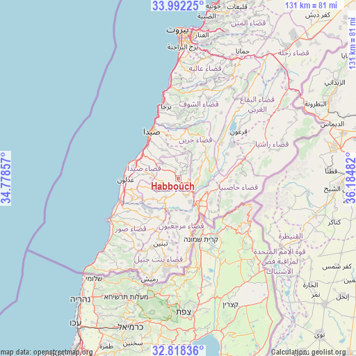
Habboûch GPS coordinates[2]
33° 24' 26.244" North, 35° 28' 54.084" East
| Map corner | latitude | longitude |
|---|---|---|
| Upper-left | 33.99225°, | 34.77857° |
| Center: | 33.40729°, | 35.48169° |
| Lower-right: | 32.81836°, | 36.18482° |
| Map W x H: | 130.5×130.5 km | = 81.1×81.1mi |
| max Lat: | 34.54278° ⇑78.1% North |
| Habboûch: | 33.40729° |
| min Lat: | ⇓21.9% South 33.11023° |
| min Long | Habboûch | max Long |
| 35.13972° | 35.48169° | 36.38472° |
| W 15.6%⇐ | ⇒84.4% E |
Elevation
Elevation of Habboûch is 457 m = 1499 ft, and this is 98.2 m = 322 ft below average elevation for this country.
| Max E: |
1442 m = 4731 ft | 53.1% |
| Avg. | 555.2 m = 1822 ft | |
| Habboûch | 457 m = 1499 ft | |
Min E: |
7 m = 23 ft | 46.9% |
See also: Habboûch elevation on elevation.city.
Geographical zone
Habboûch is located in North temperate zone (between Tropic of Cancer and the Arctic Circle). Distance of this Northern Tropic circle is 1108.6 km =688.9 mi to South.| Distance of | km | miles | from Habboûch |
|---|---|---|---|
| North Pole | 6292.5 | 3910 | to North |
| Arctic Circle | 3686.6 | 2290.7 | to North |
| Tropic Cancer | 1108.6 | 688.9 | to South |
| Equator | 3714.5 | 2308.1 | to South |


Nearby cities:
15 places around Habboûch: (largest is in red/bold)
• Aaley
45.6 km =28.3 mi,  13°
13°
• Ain Ebel
33.8 km =21 mi,  192°
192°
• Bent Jbaïl
32.3 km =20.1 mi, 187°
• Beït ed Dîne
33.2 km =20.6 mi,  16°
16°
• Bhamdoun
45.9 km =28.5 mi, 19°
• Bhamdoûn el Mhatta
47.6 km =29.6 mi, 20°
• En Nâqoûra
45.2 km =28.1 mi,  224°
224°
• Hâsbaïya
18.9 km =11.7 mi,  93°
93°
• Jezzîne
17.7 km =11 mi,  32°
32°
• Joubb Jannîne
37.2 km =23.1 mi,  48°
48°
• Marjayoûn
11.4 km =7.1 mi,  117°
117°
• Nabatîyé et Tahta
3.2 km =2 mi,  176°
176°
• Râchaïya el Ouadi
35.2 km =21.9 mi,  72°
72°
• Sidon
19.6 km =12.2 mi,  328°
328°
• Tyre
30.6 km =19 mi,  240°
240°
Sources, notices
• [Note1] Compared only with cities in Lebanon existing in our database
• [Src1] Map data: © OpenStreetMap contributors (CC-BY-SA)
• [Src2] Other city data from geonames.org with taken over terms of usage.
• [Src3] Geographical zone / Annual Mean Temperature by Robert A. Rohde @ Wikipedia
