Ain Ebel geodata
Ain Ebel (Nabatîyé) is a populated place; located in Lebanon in Asia/Beirut (GMT+3) time zone. With population of 2,000 people, there are 17 cities with bigger population in this country. Compared to other cities in Lebanon, 100% of cities are located further ↑North; 90.6% of cities are located further →East and 62.5% of cities have lower elevation than Ain Ebel. Note1


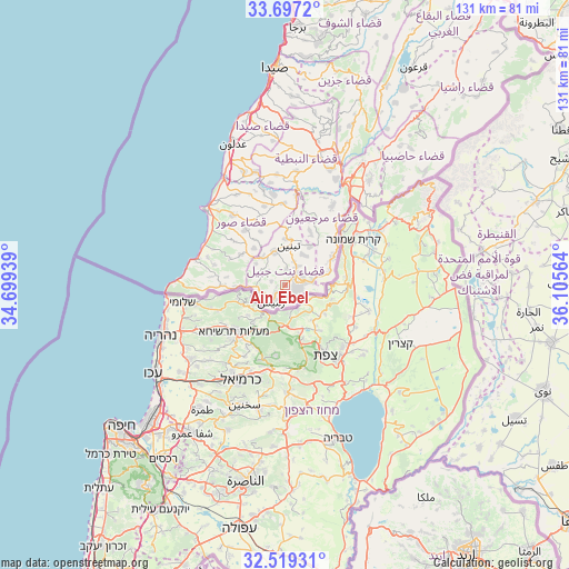
Ain Ebel GPS coordinates[2]
33° 6' 36.828" North, 35° 24' 9.036" East
| Map corner | latitude | longitude |
|---|---|---|
| Upper-left | 33.6972°, | 34.69939° |
| Center: | 33.11023°, | 35.40251° |
| Lower-right: | 32.51931°, | 36.10564° |
| Map W x H: | 131×131 km | = 81.4×81.4mi |
| max Lat: | 34.54278° ⇑100% North |
| Ain Ebel: | 33.11023° |
| min Lat: | ⇓0% South 33.11023° |
| min Long | Ain Ebel | max Long |
| 35.13972° | 35.40251° | 36.38472° |
| W 9.4%⇐ | ⇒90.6% E |
Elevation
Elevation of Ain Ebel is 758 m = 2487 ft, and this is 202.8 m = 665 ft above average elevation for this country.
| Max E: |
1442 m = 4731 ft | 37.5% |
| Ain Ebel | 758 m 2487 ft | |
| Avg. | 555.2 m = 1822 ft | |
Min E: |
7 m = 23 ft | 62.5% |
See also: Lebanon elevation on elevation.city.
Geographical zone
Ain Ebel is located in North temperate zone (between Tropic of Cancer and the Arctic Circle). Distance of this Northern Tropic circle is 1075.6 km =668.3 mi to South.| Distance of | km | miles | from Ain Ebel |
|---|---|---|---|
| North Pole | 6325.5 | 3930.5 | to North |
| Arctic Circle | 3719.7 | 2311.3 | to North |
| Tropic Cancer | 1075.6 | 668.3 | to South |
| Equator | 3681.5 | 2287.6 | to South |


Nearby cities:
15 places around Ain Ebel: (largest is in red/bold)
• Aaley
79.4 km =49.3 mi,  13°
13°
• Bent Jbaïl
3 km =1.9 mi,  70°
70°
• Beït ed Dîne
67 km =41.6 mi, 14°
• Bhamdoun
79.6 km =49.5 mi,  16°
16°
• Bhamdoûn el Mhatta
81.2 km =50.5 mi, 17°
• En Nâqoûra
24.5 km =15.2 mi,  272°
272°
• Habboûch
33.8 km =21 mi, 12°
• Hâsbaïya
41.4 km =25.7 mi,  39°
39°
• Jezzîne
50.9 km =31.6 mi, 19°
• Joubb Jannîne
67.5 km =41.9 mi,  31°
31°
• Marjayoûn
32.9 km =20.4 mi, 32°
• Nabatîyé et Tahta
30.8 km =19.1 mi, 14°
• Râchaïya el Ouadi
59.7 km =37.1 mi, 43°
• Sidon
49.8 km =30.9 mi,  356°
356°
• Tyre
26.6 km =16.5 mi,  313°
313°
Sources, notices
• [Note1] Compared only with cities in Lebanon existing in our database
• [Src1] Map data: © OpenStreetMap contributors (CC-BY-SA)
• [Src2] Other city data from geonames.org with taken over terms of usage.
• [Src3] Geographical zone / Annual Mean Temperature by Robert A. Rohde @ Wikipedia
