Hâsbaïya geodata
Hâsbaïya (Nabatîyé) is a seat of a second-order administrative division; located in Lebanon in Asia/Beirut (GMT+3) time zone. In our database, there are 19 cities with bigger population. Compared to other cities in Lebanon, 81.2% of cities are located further ↑North; 62.5% of cities are located further ←West and 59.4% of cities have lower elevation than Hâsbaïya. Note1


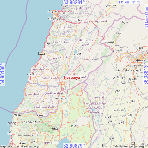
Hâsbaïya GPS coordinates[2]
33° 23' 52.008" North, 35° 41' 6" East
| Map corner | latitude | longitude |
|---|---|---|
| Upper-left | 33.98281°, | 34.98188° |
| Center: | 33.39778°, | 35.685° |
| Lower-right: | 32.80879°, | 36.38813° |
| Map W x H: | 130.5×130.5 km | = 81.1×81.1mi |
| max Lat: | 34.54278° ⇑81.2% North |
| Hâsbaïya: | 33.39778° |
| min Lat: | ⇓18.8% South 33.11023° |
| min Long | Hâsbaïya | max Long |
| 35.13972° | 35.685° | 36.38472° |
| W 62.5%⇐ | ⇒37.5% E |
Elevation
Elevation of Hâsbaïya is 747 m = 2451 ft, and this is 191.8 m = 629 ft above average elevation for this country.
| Max E: |
1442 m = 4731 ft | 40.6% |
| Hâsbaïya | 747 m 2451 ft | |
| Avg. | 555.2 m = 1822 ft | |
Min E: |
7 m = 23 ft | 59.4% |
See also: Lebanon elevation on elevation.city.
Geographical zone
Hâsbaïya is located in North temperate zone (between Tropic of Cancer and the Arctic Circle). Distance of this Northern Tropic circle is 1107.6 km =688.2 mi to South.| Distance of | km | miles | from Hâsbaïya |
|---|---|---|---|
| North Pole | 6293.6 | 3910.7 | to North |
| Arctic Circle | 3687.7 | 2291.4 | to North |
| Tropic Cancer | 1107.6 | 688.2 | to South |
| Equator | 3713.5 | 2307.5 | to South |


Nearby cities:
15 places around Hâsbaïya: (largest is in red/bold)
• Aaley
46 km =28.6 mi,  350°
350°
• Aanjar
43.2 km =26.8 mi,  31°
31°
• Ain Ebel
41.4 km =25.7 mi,  219°
219°
• Bent Jbaïl
38.8 km =24.1 mi, 217°
• Beït ed Dîne
34.3 km =21.3 mi,  343°
343°
• Bhamdoun
44.3 km =27.5 mi,  355°
355°
• Bhamdoûn el Mhatta
45.7 km =28.4 mi, 357°
• Habboûch
18.9 km =11.7 mi,  273°
273°
• Jezzîne
18.5 km =11.5 mi,  329°
329°
• Joubb Jannîne
27.1 km =16.8 mi,  19°
19°
• Marjayoûn
9.7 km =6 mi,  244°
244°
• Nabatîyé et Tahta
18.8 km =11.7 mi,  263°
263°
• Râchaïya el Ouadi
18.7 km =11.6 mi,  52°
52°
• Sidon
34.1 km =21.2 mi,  301°
301°
• Tyre
47.7 km =29.6 mi,  253°
253°
Sources, notices
• [Note1] Compared only with cities in Lebanon existing in our database
• [Src1] Map data: © OpenStreetMap contributors (CC-BY-SA)
• [Src2] Other city data from geonames.org with taken over terms of usage.
• [Src3] Geographical zone / Annual Mean Temperature by Robert A. Rohde @ Wikipedia
