Tyre geodata
Tyre (South Governorate) is a seat of a second-order administrative division; located in Lebanon in Asia/Beirut (GMT+3) time zone. With population of 135,204 people, there are 4 cities with bigger population in this country. Compared to other cities in Lebanon, 90.6% of cities are located further ↑North; 96.9% of cities are located further →East and 100% of cities have higher elevation than Tyre. Note1


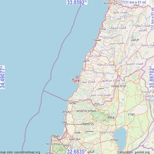
Tyre GPS coordinates[2]
33° 16' 23.988" North, 35° 11' 38.004" East
| Map corner | latitude | longitude |
|---|---|---|
| Upper-left | 33.8592°, | 34.49077° |
| Center: | 33.27333°, | 35.19389° |
| Lower-right: | 32.6835°, | 35.89702° |
| Map W x H: | 130.7×130.7 km | = 81.2×81.2mi |
| max Lat: | 34.54278° ⇑90.6% North |
| Tyre: | 33.27333° |
| min Lat: | ⇓9.4% South 33.11023° |
| min Long | Tyre | max Long |
| 35.13972° | 35.19389° | 36.38472° |
| W 3.1%⇐ | ⇒96.9% E |
Elevation
Elevation of Tyre is 7 m = 23 ft, and this is 548.2 m = 1799 ft below average elevation for this country.
| Max E: |
1442 m = 4731 ft | 100% |
| Avg. | 555.2 m = 1822 ft | |
| Tyre | 7 m = 23 ft | |
Min E: |
7 m = 23 ft | 0% |
See also: Tyre elevation on elevation.city.
Geographical zone
Tyre is located in North temperate zone (between Tropic of Cancer and the Arctic Circle). Distance of this Northern Tropic circle is 1093.7 km =679.6 mi to South.| Distance of | km | miles | from Tyre |
|---|---|---|---|
| North Pole | 6307.4 | 3919.2 | to North |
| Arctic Circle | 3701.5 | 2300 | to North |
| Tropic Cancer | 1093.7 | 679.6 | to South |
| Equator | 3699.6 | 2298.8 | to South |


Nearby cities:
15 places around Tyre: (largest is in red/bold)
• Aaley
70.1 km =43.6 mi,  32°
32°
• Ain Ebel
26.6 km =16.5 mi,  133°
133°
• Baabda
70.3 km =43.7 mi, 27°
• Bent Jbaïl
28.1 km =17.5 mi, 127°
• Beït ed Dîne
59 km =36.7 mi,  37°
37°
• Bhamdoun
71.8 km =44.6 mi, 36°
• En Nâqoûra
18 km =11.2 mi,  196°
196°
• Habboûch
30.6 km =19 mi,  60°
60°
• Hâsbaïya
47.7 km =29.6 mi,  73°
73°
• Jezzîne
46.9 km =29.1 mi,  50°
50°
• Joubb Jannîne
67.4 km =41.9 mi, 54°
• Marjayoûn
38.2 km =23.7 mi,  75°
75°
• Nabatîyé et Tahta
29.4 km =18.3 mi, 66°
• Râchaïya el Ouadi
65.4 km =40.6 mi, 67°
• Sidon
35.6 km =22.1 mi, 27°
In other languages:
- In Spanish: Tiro
- In France: Tyr
- In German: Tyros
- In Italian: Tiro
- In Russian: Тир
Sources, notices
• [Note1] Compared only with cities in Lebanon existing in our database
• [Src1] Map data: © OpenStreetMap contributors (CC-BY-SA)
• [Src2] Other city data from geonames.org with taken over terms of usage.
• [Src3] Geographical zone / Annual Mean Temperature by Robert A. Rohde @ Wikipedia
