Joubb Jannîne geodata
Joubb Jannîne (Béqaa) is a seat of a second-order administrative division; located in Lebanon in Asia/Beirut (GMT+3) time zone. In our database, there are 19 cities with bigger population. Compared to other cities in Lebanon, 65.6% of cities are located further ↑North; 65.6% of cities are located further ←West and 78.1% of cities have lower elevation than Joubb Jannîne. Note1


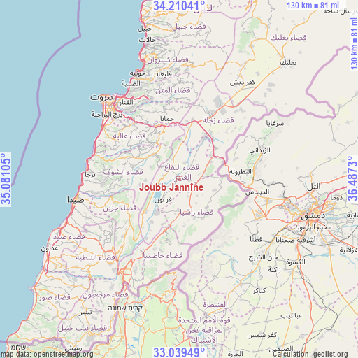
Joubb Jannîne GPS coordinates[2]
33° 37' 36.984" North, 35° 47' 3.012" East
| Map corner | latitude | longitude |
|---|---|---|
| Upper-left | 34.21041°, | 35.08105° |
| Center: | 33.62694°, | 35.78417° |
| Lower-right: | 33.03949°, | 36.4873° |
| Map W x H: | 130.2×130.2 km | = 80.9×80.9mi |
| max Lat: | 34.54278° ⇑65.6% North |
| Joubb Jannîne: | 33.62694° |
| min Lat: | ⇓34.4% South 33.11023° |
| min Long | Joubb Jannîne | max Long |
| 35.13972° | 35.78417° | 36.38472° |
| W 65.6%⇐ | ⇒34.4% E |
Elevation
Elevation of Joubb Jannîne is 945 m = 3100 ft, and this is 389.8 m = 1279 ft above average elevation for this country.
| Max E: |
1442 m = 4731 ft | 21.9% |
| Joubb Jannîne | 945 m 3100 ft | |
| Avg. | 555.2 m = 1822 ft | |
Min E: |
7 m = 23 ft | 78.1% |
See also: Lebanon elevation on elevation.city.
Geographical zone
Joubb Jannîne is located in North temperate zone (between Tropic of Cancer and the Arctic Circle). Distance of this Northern Tropic circle is 1133 km =704 mi to South.| Distance of | km | miles | from Joubb Jannîne |
|---|---|---|---|
| North Pole | 6268.1 | 3894.8 | to North |
| Arctic Circle | 3662.2 | 2275.6 | to North |
| Tropic Cancer | 1133 | 704 | to South |
| Equator | 3739 | 2323.3 | to South |


Nearby cities:
15 places around Joubb Jannîne: (largest is in red/bold)
• Aaley
26.1 km =16.2 mi,  319°
319°
• Aanjar
17.6 km =10.9 mi,  50°
50°
• Baabda
32 km =19.9 mi, 316°
• Beït ed Dîne
20.2 km =12.6 mi,  291°
291°
• Bhamdoun
22.4 km =13.9 mi,  326°
326°
• Bhamdoûn el Mhatta
23.2 km =14.4 mi, 330°
• Habboûch
37.2 km =23.1 mi,  228°
228°
• Hâsbaïya
27.1 km =16.8 mi,  199°
199°
• Jdaidet el Matn
35.6 km =22.1 mi, 325°
• Jezzîne
20.8 km =12.9 mi,  242°
242°
• Marjayoûn
34.6 km =21.5 mi,  211°
211°
• Nabatîyé et Tahta
39.2 km =24.4 mi, 225°
• Râchaïya el Ouadi
15.1 km =9.4 mi,  158°
158°
• Sidon
39 km =24.2 mi,  258°
258°
• Zahlé
26.8 km =16.7 mi,  24°
24°
Sources, notices
• [Note1] Compared only with cities in Lebanon existing in our database
• [Src1] Map data: © OpenStreetMap contributors (CC-BY-SA)
• [Src2] Other city data from geonames.org with taken over terms of usage.
• [Src3] Geographical zone / Annual Mean Temperature by Robert A. Rohde @ Wikipedia
