Jurbarkas geodata
Jurbarkas (Tauragė County) is a seat of a second-order administrative division; located in Lithuania in Europe/Vilnius (GMT+3) time zone. With population of 13,102 people, there are 39 cities with bigger population in this country. Compared to other cities in Lithuania, 53% of cities are located further ↑North; 76.9% of cities are located further →East and 94% of cities have higher elevation than Jurbarkas. Note1


Jurbarkas GPS coordinates[2]
55° 4' 32.016" North, 22° 45' 50.976" East
| Map corner | latitude | longitude |
|---|---|---|
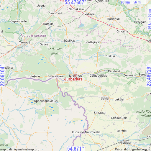
| Upper-left | 55.47607°, | 22.06104° |
| Center: | 55.07556°, | 22.76416° |
| Lower-right: | 54.671°, | 23.46729° |
| Map W x H: | 89.5×89.5 km | = 55.6×55.6mi |
| max Lat: | 56.36149° ⇑53% North |
| Jurbarkas: | 55.07556° |
| min Lat: | ⇓47% South 54.01573° |
| min Long | Jurbarkas | max Long |
| 20.99651° | 22.76416° | 26.43984° |
| W 23.1%⇐ | ⇒76.9% E |
Elevation
Elevation of Jurbarkas is 18 m = 59 ft, and this is 72.7 m = 239 ft below average elevation for this country.
| Max E: |
204 m = 669 ft | 94% |
| Avg. | 90.7 m = 298 ft | |
| Jurbarkas | 18 m = 59 ft | |
Min E: |
-1 m = -3 ft | 6% |
See also: Lithuania elevation on elevation.city.
Geographical zone
Jurbarkas is located in North temperate zone (between Tropic of Cancer and the Arctic Circle). Distance of this North polar circle is 1277.3 km =793.7 mi to North.| Distance of | km | miles | from Jurbarkas |
|---|---|---|---|
| North Pole | 3883.2 | 2412.9 | to North |
| Arctic Circle | 1277.3 | 793.7 | to North |
| Tropic Cancer | 3517.9 | 2185.9 | to South |
| Equator | 6123.8 | 3805.2 | to South |


Nearby cities:
15 places around Jurbarkas: (largest is in red/bold)
• Ariogala
49.8 km =30.9 mi,  65°
65°
• Būgai
38.9 km =24.2 mi,  345°
345°
• Ežerėlis
57.7 km =35.9 mi,  111°
111°
• Gelgaudiškis
13.5 km =8.4 mi,  89°
89°
• Kudirkos Naumiestis
34.2 km =21.3 mi,  169°
169°
• Kulautuva
57.9 km =36 mi,  104°
104°
• Kybartai
48.6 km =30.2 mi,  180°
180°
• Pagėgiai
54.5 km =33.9 mi,  277°
277°
• Raseiniai
40.8 km =25.4 mi,  33°
33°
• Smalininkai
11.5 km =7.1 mi,  270°
270°
• Taurage
36 km =22.4 mi,  303°
303°
• Vilkaviskis
50.2 km =31.2 mi,  160°
160°
• Vilkija
52.4 km =32.6 mi, 93°
• Virbalis
49.8 km =30.9 mi, 175°
• Šakiai
22.6 km =14 mi,  126°
126°
Sources, notices
• [Note1] Compared only with cities in Lithuania existing in our database
• [Src1] Map data: © OpenStreetMap contributors (CC-BY-SA)
• [Src2] Other city data from geonames.org with taken over terms of usage.
• [Src3] Geographical zone / Annual Mean Temperature by Robert A. Rohde @ Wikipedia
