Kopstal geodata
Kopstal (Capellen) is a seat of a third-order administrative division; located in Luxembourg in Europe/Luxembourg (GMT+2) time zone. With population of 657 people, there are 121 cities with bigger population in this country. Compared to other cities in Luxembourg, 50.3% of cities are located further ↑North; 58.2% of cities are located further →East and 64.4% of cities have higher elevation than Kopstal. Note1


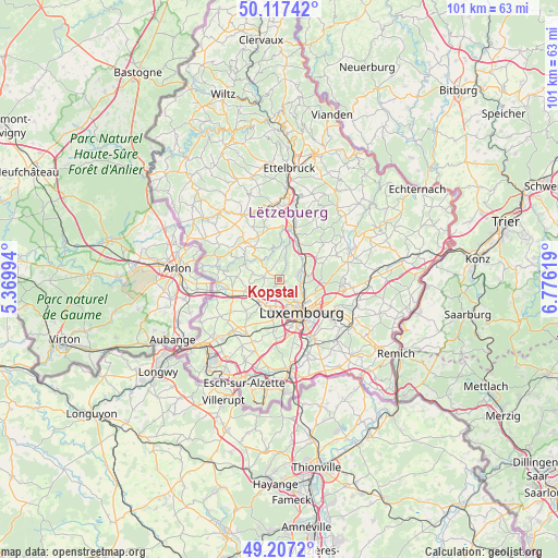
Kopstal GPS coordinates[2]
49° 39' 51.984" North, 6° 4' 23.016" East
| Map corner | latitude | longitude |
|---|---|---|
| Upper-left | 50.11742°, | 5.36994° |
| Center: | 49.66444°, | 6.07306° |
| Lower-right: | 49.2072°, | 6.77619° |
| Map W x H: | 101.2×101.2 km | = 62.9×62.9mi |
| max Lat: | 50.13722° ⇑50.3% North |
| Kopstal: | 49.66444° |
| min Lat: | ⇓49.7% South 49.45964° |
| min Long | Kopstal | max Long |
| 5.76583° | 6.07306° | 6.50532° |
| W 41.8%⇐ | ⇒58.2% E |
Elevation
Elevation of Kopstal is 261 m = 856 ft, and this is 21 m = 69 ft below average elevation for this country.
| Max E: |
502 m = 1647 ft | 64.4% |
| Avg. | 282 m = 925 ft | |
| Kopstal | 261 m = 856 ft | |
Min E: |
143 m = 469 ft | 35.6% |
See also: Luxembourg elevation on elevation.city.
Geographical zone
Kopstal is located in North temperate zone (between Tropic of Cancer and the Arctic Circle). Distance of this North polar circle is 1879 km =1167.6 mi to North.| Distance of | km | miles | from Kopstal |
|---|---|---|---|
| North Pole | 4484.9 | 2786.8 | to North |
| Arctic Circle | 1879 | 1167.6 | to North |
| Tropic Cancer | 2916.2 | 1812 | to South |
| Equator | 5522.2 | 3431.3 | to South |


Nearby cities:
15 places around Kopstal: (largest is in red/bold)
• Bofferdange
5.6 km =3.5 mi,  58°
58°
• Bridel
1.1 km =0.7 mi,  152°
152°
• Béreldange
3.4 km =2.1 mi,  107°
107°
• Heisdorf
5 km =3.1 mi,  80°
80°
• Helmdange
5.9 km =3.7 mi, 56°
• Helmsange
5.1 km =3.2 mi,  104°
104°
• Kehlen
2.7 km =1.7 mi,  279°
279°
• Keispelt
3.3 km =2.1 mi,  353°
353°
• Mamer
5.4 km =3.4 mi,  221°
221°
• Müllendorf
4.5 km =2.8 mi,  66°
66°
• Nospelt
4.8 km =3 mi, 284°
• Olm
5.3 km =3.3 mi,  261°
261°
• Steinsel
3.9 km =2.4 mi, 69°
• Strassen
4.9 km =3 mi,  179°
179°
• Walferdange
4.3 km =2.7 mi,  91°
91°
Sources, notices
• [Note1] Compared only with cities in Luxembourg existing in our database
• [Src1] Map data: © OpenStreetMap contributors (CC-BY-SA)
• [Src2] Other city data from geonames.org with taken over terms of usage.
• [Src3] Geographical zone / Annual Mean Temperature by Robert A. Rohde @ Wikipedia
