Müllendorf geodata
Müllendorf (Luxembourg) is a populated place; located in Luxembourg in Europe/Luxembourg (GMT+2) time zone. With population of 1,024 people, there are 79 cities with bigger population in this country. Compared to other cities in Luxembourg, 54.8% of cities are located further ↓South; 53.1% of cities are located further ←West and 79.7% of cities have higher elevation than Müllendorf. Note1


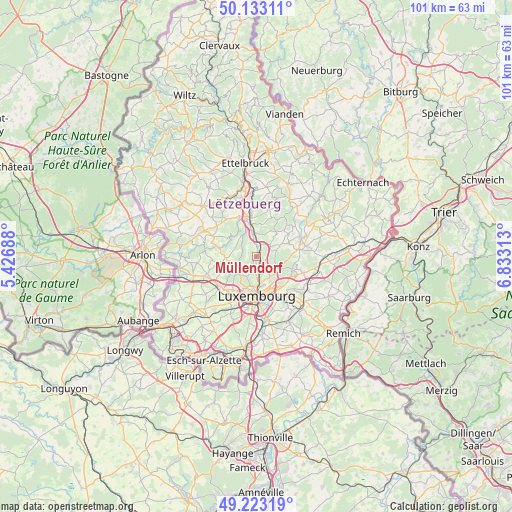
Müllendorf GPS coordinates[2]
49° 40' 49.008" North, 6° 7' 48" East
| Map corner | latitude | longitude |
|---|---|---|
| Upper-left | 50.13311°, | 5.42688° |
| Center: | 49.68028°, | 6.13° |
| Lower-right: | 49.22319°, | 6.83313° |
| Map W x H: | 101.2×101.2 km | = 62.9×62.9mi |
| max Lat: | 50.13722° ⇑45.2% North |
| Müllendorf: | 49.68028° |
| min Lat: | ⇓54.8% South 49.45964° |
| min Long | Müllendorf | max Long |
| 5.76583° | 6.13° | 6.50532° |
| W 53.1%⇐ | ⇒46.9% E |
Elevation
Elevation of Müllendorf is 228 m = 748 ft, and this is 54 m = 177 ft below average elevation for this country.
| Max E: |
502 m = 1647 ft | 79.7% |
| Avg. | 282 m = 925 ft | |
| Müllendorf | 228 m = 748 ft | |
Min E: |
143 m = 469 ft | 20.3% |
See also: Luxembourg elevation on elevation.city.
Geographical zone
Müllendorf is located in North temperate zone (between Tropic of Cancer and the Arctic Circle). Distance of this North polar circle is 1877.2 km =1166.4 mi to North.| Distance of | km | miles | from Müllendorf |
|---|---|---|---|
| North Pole | 4483.1 | 2785.7 | to North |
| Arctic Circle | 1877.2 | 1166.4 | to North |
| Tropic Cancer | 2918 | 1813.2 | to South |
| Equator | 5523.9 | 3432.4 | to South |


Nearby cities:
15 places around Müllendorf: (largest is in red/bold)
• Bofferdange
1.4 km =0.9 mi,  31°
31°
• Bourglinster
6.8 km =4.2 mi,  68°
68°
• Bridel
4.5 km =2.8 mi,  232°
232°
• Béreldange
2.9 km =1.8 mi,  196°
196°
• Heisdorf
1.3 km =0.8 mi,  136°
136°
• Helmdange
1.7 km =1.1 mi, 29°
• Helmsange
3.2 km =2 mi,  164°
164°
• Kehlen
6.9 km =4.3 mi,  258°
258°
• Keispelt
4.7 km =2.9 mi,  288°
288°
• Kirchberg
6.4 km =4 mi,  167°
167°
• Kopstal
4.5 km =2.8 mi,  246°
246°
• Lintgen
4.7 km =2.9 mi,  0°
0°
• Lorentzweiler
2.5 km =1.6 mi,  20°
20°
• Steinsel
0.6 km =0.4 mi, 229°
• Walferdange
1.9 km =1.2 mi,  175°
175°
Sources, notices
• [Note1] Compared only with cities in Luxembourg existing in our database
• [Src1] Map data: © OpenStreetMap contributors (CC-BY-SA)
• [Src2] Other city data from geonames.org with taken over terms of usage.
• [Src3] Geographical zone / Annual Mean Temperature by Robert A. Rohde @ Wikipedia
