Beckerich geodata
Beckerich (Redange) is a seat of a third-order administrative division; located in Luxembourg in Europe/Luxembourg (GMT+2) time zone. With population of 672 people, there are 118 cities with bigger population in this country. Compared to other cities in Luxembourg, 66.7% of cities are located further ↓South; 94.4% of cities are located further →East and 63.8% of cities have lower elevation than Beckerich. Note1


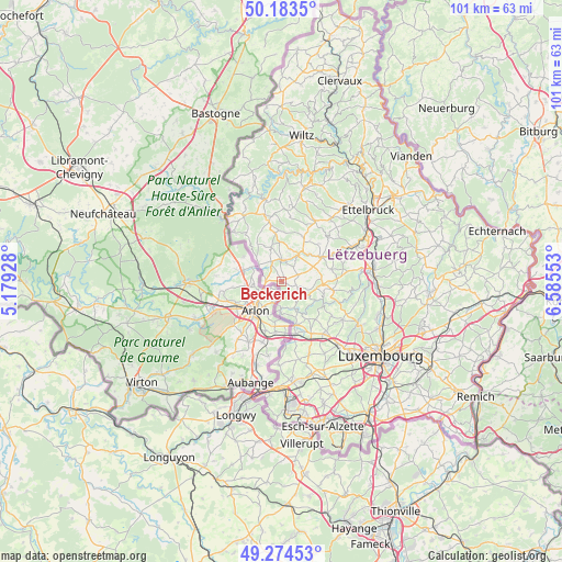
Beckerich GPS coordinates[2]
49° 43' 52.104" North, 5° 52' 56.676" East
| Map corner | latitude | longitude |
|---|---|---|
| Upper-left | 50.1835°, | 5.17928° |
| Center: | 49.73114°, | 5.88241° |
| Lower-right: | 49.27453°, | 6.58553° |
| Map W x H: | 101.1×101.1 km | = 62.8×62.8mi |
| max Lat: | 50.13722° ⇑33.3% North |
| Beckerich: | 49.73114° |
| min Lat: | ⇓66.7% South 49.45964° |
| min Long | Beckerich | max Long |
| 5.76583° | 5.88241° | 6.50532° |
| W 5.6%⇐ | ⇒94.4% E |
Elevation
Elevation of Beckerich is 300 m = 984 ft, and this is 18 m = 59 ft above average elevation for this country.
| Max E: |
502 m = 1647 ft | 36.2% |
| Beckerich | 300 m 984 ft | |
| Avg. | 282 m = 925 ft | |
Min E: |
143 m = 469 ft | 63.8% |
See also: Luxembourg elevation on elevation.city.
Geographical zone
Beckerich is located in North temperate zone (between Tropic of Cancer and the Arctic Circle). Distance of this North polar circle is 1871.6 km =1163 mi to North.| Distance of | km | miles | from Beckerich |
|---|---|---|---|
| North Pole | 4477.5 | 2782.2 | to North |
| Arctic Circle | 1871.6 | 1163 | to North |
| Tropic Cancer | 2923.7 | 1816.7 | to South |
| Equator | 5529.6 | 3435.9 | to South |


Nearby cities:
15 places around Beckerich: (largest is in red/bold)
• Bettborn
8.3 km =5.2 mi,  30°
30°
• Brouch
10.1 km =6.3 mi,  86°
86°
• Eischen
5.1 km =3.2 mi,  183°
183°
• Ell
4.1 km =2.5 mi,  333°
333°
• Hagen
9.8 km =6.1 mi,  158°
158°
• Hobscheid
5.3 km =3.3 mi,  153°
153°
• Kleinbettingen
9.7 km =6 mi,  165°
165°
• Koerich
8.4 km =5.2 mi,  144°
144°
• Platen
7.4 km =4.6 mi, 29°
• Redange-sur-Attert
3.7 km =2.3 mi,  8°
8°
• Saeul
7.5 km =4.7 mi, 93°
• Septfontaines
7 km =4.3 mi,  118°
118°
• Steinfort
8.2 km =5.1 mi, 161°
• Tuntange
9.3 km =5.8 mi,  99°
99°
• Useldange
8.4 km =5.2 mi,  59°
59°
Sources, notices
• [Note1] Compared only with cities in Luxembourg existing in our database
• [Src1] Map data: © OpenStreetMap contributors (CC-BY-SA)
• [Src2] Other city data from geonames.org with taken over terms of usage.
• [Src3] Geographical zone / Annual Mean Temperature by Robert A. Rohde @ Wikipedia
