Septfontaines geodata
Septfontaines (Capellen) is a seat of a third-order administrative division; located in Luxembourg in Europe/Luxembourg (GMT+2) time zone. With population of 363 people, there are 157 cities with bigger population in this country. Compared to other cities in Luxembourg, 59.9% of cities are located further ↓South; 79.1% of cities are located further →East and 59.3% of cities have higher elevation than Septfontaines. Note1


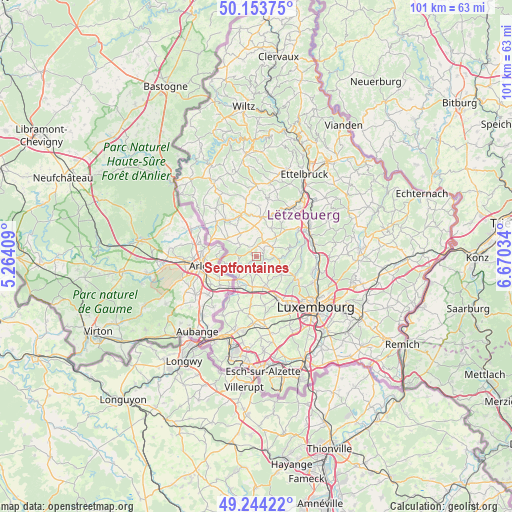
Septfontaines GPS coordinates[2]
49° 42' 3.996" North, 5° 58' 1.992" East
| Map corner | latitude | longitude |
|---|---|---|
| Upper-left | 50.15375°, | 5.26409° |
| Center: | 49.70111°, | 5.96722° |
| Lower-right: | 49.24422°, | 6.67034° |
| Map W x H: | 101.1×101.1 km | = 62.8×62.8mi |
| max Lat: | 50.13722° ⇑40.1% North |
| Septfontaines: | 49.70111° |
| min Lat: | ⇓59.9% South 49.45964° |
| min Long | Septfontaines | max Long |
| 5.76583° | 5.96722° | 6.50532° |
| W 20.9%⇐ | ⇒79.1% E |
Elevation
Elevation of Septfontaines is 267 m = 876 ft, and this is 15 m = 49 ft below average elevation for this country.
| Max E: |
502 m = 1647 ft | 59.3% |
| Avg. | 282 m = 925 ft | |
| Septfontaines | 267 m = 876 ft | |
Min E: |
143 m = 469 ft | 40.7% |
See also: Luxembourg elevation on elevation.city.
Geographical zone
Septfontaines is located in North temperate zone (between Tropic of Cancer and the Arctic Circle). Distance of this North polar circle is 1874.9 km =1165 mi to North.| Distance of | km | miles | from Septfontaines |
|---|---|---|---|
| North Pole | 4480.8 | 2784.2 | to North |
| Arctic Circle | 1874.9 | 1165 | to North |
| Tropic Cancer | 2920.3 | 1814.6 | to South |
| Equator | 5526.2 | 3433.8 | to South |


Nearby cities:
15 places around Septfontaines: (largest is in red/bold)
• Beckerich
7 km =4.3 mi,  298°
298°
• Brouch
5.6 km =3.5 mi,  45°
45°
• Capellen
6.5 km =4 mi,  164°
164°
• Eischen
6.6 km =4.1 mi,  254°
254°
• Hagen
6.3 km =3.9 mi,  204°
204°
• Hobscheid
4 km =2.5 mi, 249°
• Kehlen
6.1 km =3.8 mi,  126°
126°
• Keispelt
7.3 km =4.5 mi,  96°
96°
• Kleinbettingen
7.1 km =4.4 mi,  211°
211°
• Koerich
3.7 km =2.3 mi, 199°
• Nospelt
4.2 km =2.6 mi, 133°
• Olm
5.4 km =3.4 mi,  154°
154°
• Saeul
3.2 km =2 mi,  25°
25°
• Steinfort
5.6 km =3.5 mi,  218°
218°
• Tuntange
3.6 km =2.2 mi,  59°
59°
Sources, notices
• [Note1] Compared only with cities in Luxembourg existing in our database
• [Src1] Map data: © OpenStreetMap contributors (CC-BY-SA)
• [Src2] Other city data from geonames.org with taken over terms of usage.
• [Src3] Geographical zone / Annual Mean Temperature by Robert A. Rohde @ Wikipedia
