Smārde geodata
Smārde (Engure) is a seat of a first-order administrative division; located in Latvia in Europe/Riga (GMT+3) time zone. With population of 734 people, there are 105 cities with bigger population in this country. Compared to other cities in Latvia, 52.9% of cities are located further ↓South; 77.1% of cities are located further →East and 76.4% of cities have higher elevation than Smārde. Note1


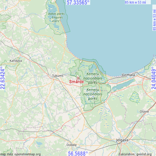
Smārde GPS coordinates[2]
56° 57' 15.12" North, 23° 20' 14.496" East
| Map corner | latitude | longitude |
|---|---|---|
| Upper-left | 57.33565°, | 22.63424° |
| Center: | 56.9542°, | 23.33736° |
| Lower-right: | 56.5688°, | 24.04049° |
| Map W x H: | 85.3×85.3 km | = 53×53mi |
| max Lat: | 57.89752° ⇑47.1% North |
| Smārde: | 56.9542° |
| min Lat: | ⇓52.9% South 55.75284° |
| min Long | Smārde | max Long |
| 21.01085° | 23.33736° | 28.12165° |
| W 22.9%⇐ | ⇒77.1% E |
Elevation
Elevation of Smārde is 21 m = 69 ft, and this is 44.4 m = 146 ft below average elevation for this country.
| Max E: |
212 m = 696 ft | 76.4% |
| Avg. | 65.4 m = 215 ft | |
| Smārde | 21 m = 69 ft | |
Min E: |
2 m = 7 ft | 23.6% |
See also: Latvia elevation on elevation.city.
Geographical zone
Smārde is located in North temperate zone (between Tropic of Cancer and the Arctic Circle). Distance of this North polar circle is 1068.5 km =663.9 mi to North.| Distance of | km | miles | from Smārde |
|---|---|---|---|
| North Pole | 3674.3 | 2283.1 | to North |
| Arctic Circle | 1068.5 | 663.9 | to North |
| Tropic Cancer | 3726.8 | 2315.7 | to South |
| Equator | 6332.7 | 3935 | to South |


Nearby cities:
15 places around Smārde: (largest is in red/bold)
• Daugavgrīva
43.5 km =27 mi,  76°
76°
• Dobele
36.9 km =22.9 mi,  185°
185°
• Engure
23.9 km =14.9 mi,  343°
343°
• Jaunpils
31.7 km =19.7 mi,  218°
218°
• Jelgava
40.8 km =25.4 mi,  145°
145°
• Jūrmala
26.3 km =16.3 mi,  86°
86°
• Kandava
35.4 km =22 mi,  285°
285°
• Milzkalne
7.2 km =4.5 mi, 290°
• Mārupe
43.6 km =27.1 mi,  97°
97°
• Olaine
40.5 km =25.2 mi,  115°
115°
• Ozolnieki
39.7 km =24.7 mi,  137°
137°
• Piņķi
35 km =21.7 mi, 92°
• Ragaciems
12.2 km =7.6 mi,  51°
51°
• Tukums
11.1 km =6.9 mi,  277°
277°
• Tīreļi
19.9 km =12.4 mi,  129°
129°
Sources, notices
• [Note1] Compared only with cities in Latvia existing in our database
• [Src1] Map data: © OpenStreetMap contributors (CC-BY-SA)
• [Src2] Other city data from geonames.org with taken over terms of usage.
• [Src3] Geographical zone / Annual Mean Temperature by Robert A. Rohde @ Wikipedia
