Milzkalne geodata
Milzkalne (Engure) is a populated place; located in Latvia in Europe/Riga (GMT+3) time zone. With population of 689 people, there are 106 cities with bigger population in this country. Compared to other cities in Latvia, 57.1% of cities are located further ↓South; 78.6% of cities are located further →East and 68.6% of cities have higher elevation than Milzkalne. Note1


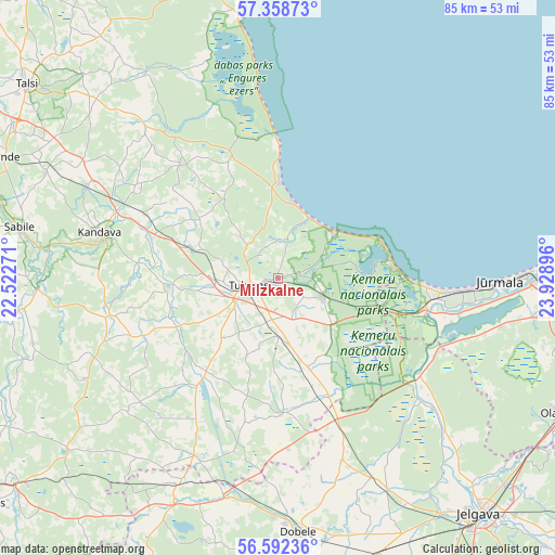
Milzkalne GPS coordinates[2]
56° 58' 39.072" North, 23° 13' 32.988" East
| Map corner | latitude | longitude |
|---|---|---|
| Upper-left | 57.35873°, | 22.52271° |
| Center: | 56.97752°, | 23.22583° |
| Lower-right: | 56.59236°, | 23.92896° |
| Map W x H: | 85.2×85.2 km | = 52.9×52.9mi |
| max Lat: | 57.89752° ⇑42.9% North |
| Milzkalne: | 56.97752° |
| min Lat: | ⇓57.1% South 55.75284° |
| min Long | Milzkalne | max Long |
| 21.01085° | 23.22583° | 28.12165° |
| W 21.4%⇐ | ⇒78.6% E |
Elevation
Elevation of Milzkalne is 33 m = 108 ft, and this is 32.4 m = 106 ft below average elevation for this country.
| Max E: |
212 m = 696 ft | 68.6% |
| Avg. | 65.4 m = 215 ft | |
| Milzkalne | 33 m = 108 ft | |
Min E: |
2 m = 7 ft | 31.4% |
See also: Latvia elevation on elevation.city.
Geographical zone
Milzkalne is located in North temperate zone (between Tropic of Cancer and the Arctic Circle). Distance of this North polar circle is 1065.9 km =662.3 mi to North.| Distance of | km | miles | from Milzkalne |
|---|---|---|---|
| North Pole | 3671.8 | 2281.6 | to North |
| Arctic Circle | 1065.9 | 662.3 | to North |
| Tropic Cancer | 3729.4 | 2317.3 | to South |
| Equator | 6335.3 | 3936.6 | to South |


Nearby cities:
15 places around Milzkalne: (largest is in red/bold)
• Dobele
39.5 km =24.5 mi,  175°
175°
• Engure
20.4 km =12.7 mi,  359°
359°
• Jaunpils
30.3 km =18.8 mi,  205°
205°
• Jelgava
47 km =29.2 mi,  140°
140°
• Jūrmala
33 km =20.5 mi,  91°
91°
• Kandava
28.2 km =17.5 mi,  284°
284°
• Mērsrags
40.3 km =25 mi,  351°
351°
• Ozolnieki
46.3 km =28.8 mi,  133°
133°
• Piņķi
41.9 km =26 mi,  95°
95°
• Ragaciems
17.1 km =10.6 mi,  73°
73°
• Sabile
40.3 km =25 mi, 280°
• Smārde
7.2 km =4.5 mi,  110°
110°
• Stende
45.7 km =28.4 mi,  294°
294°
• Tukums
4.4 km =2.7 mi,  255°
255°
• Tīreļi
26.8 km =16.7 mi,  124°
124°
Sources, notices
• [Note1] Compared only with cities in Latvia existing in our database
• [Src1] Map data: © OpenStreetMap contributors (CC-BY-SA)
• [Src2] Other city data from geonames.org with taken over terms of usage.
• [Src3] Geographical zone / Annual Mean Temperature by Robert A. Rohde @ Wikipedia
