Salacgrīva geodata
Salacgrīva (Salacgrīvas) is a seat of a first-order administrative division; located in Latvia in Europe/Riga (GMT+3) time zone. With population of 3,427 people, there are 48 cities with bigger population in this country. Compared to other cities in Latvia, 95% of cities are located further ↓South; 57.1% of cities are located further →East and 89.3% of cities have higher elevation than Salacgrīva. Note1


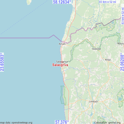
Salacgrīva GPS coordinates[2]
57° 45' 11.232" North, 24° 21' 32.22" East
| Map corner | latitude | longitude |
|---|---|---|
| Upper-left | 58.12634°, | 23.65583° |
| Center: | 57.75312°, | 24.35895° |
| Lower-right: | 57.376°, | 25.06208° |
| Map W x H: | 83.4×83.4 km | = 51.8×51.8mi |
| max Lat: | 57.89752° ⇑5% North |
| Salacgrīva: | 57.75312° |
| min Lat: | ⇓95% South 55.75284° |
| min Long | Salacgrīva | max Long |
| 21.01085° | 24.35895° | 28.12165° |
| W 42.9%⇐ | ⇒57.1% E |
Elevation
Elevation of Salacgrīva is 7 m = 23 ft, and this is 58.4 m = 192 ft below average elevation for this country.
| Max E: |
212 m = 696 ft | 89.3% |
| Avg. | 65.4 m = 215 ft | |
| Salacgrīva | 7 m = 23 ft | |
Min E: |
2 m = 7 ft | 10.7% |
See also: Latvia elevation on elevation.city.
Geographical zone
Salacgrīva is located in North temperate zone (between Tropic of Cancer and the Arctic Circle). Distance of this North polar circle is 979.6 km =608.7 mi to North.| Distance of | km | miles | from Salacgrīva |
|---|---|---|---|
| North Pole | 3585.5 | 2227.9 | to North |
| Arctic Circle | 979.6 | 608.7 | to North |
| Tropic Cancer | 3815.6 | 2370.9 | to South |
| Equator | 6421.5 | 3990.1 | to South |


Nearby cities:
15 places around Salacgrīva: (largest is in red/bold)
• Ainaži
12.3 km =7.6 mi,  359°
359°
• Aloja
30.8 km =19.1 mi,  87°
87°
• Carnikava
69.5 km =43.2 mi,  183°
183°
• Kocēni
63.8 km =39.6 mi,  113°
113°
• Limbaži
34.3 km =21.3 mi,  141°
141°
• Loja
68.8 km =42.8 mi,  165°
165°
• Matīši
47.9 km =29.8 mi,  97°
97°
• Mazsalaca
43 km =26.7 mi,  73°
73°
• Naukšēni
66.6 km =41.4 mi,  77°
77°
• Ragana
67 km =41.6 mi,  161°
161°
• Rūjiena
59.8 km =37.2 mi, 74°
• Saulkrasti
54.7 km =34 mi, 176°
• Staicele
24.8 km =15.4 mi, 68°
• Stalbe
58.4 km =36.3 mi, 136°
• Valmiera
67.8 km =42.1 mi, 110°
Sources, notices
• [Note1] Compared only with cities in Latvia existing in our database
• [Src1] Map data: © OpenStreetMap contributors (CC-BY-SA)
• [Src2] Other city data from geonames.org with taken over terms of usage.
• [Src3] Geographical zone / Annual Mean Temperature by Robert A. Rohde @ Wikipedia
