Aloja geodata
Aloja is a seat of a first-order administrative division; located in Latvia in Europe/Riga (GMT+3) time zone. With population of 1,509 people, there are 88 cities with bigger population in this country. Compared to other cities in Latvia, 95.7% of cities are located further ↓South; 55.7% of cities are located further ←West and 65.7% of cities have lower elevation than Aloja. Note1


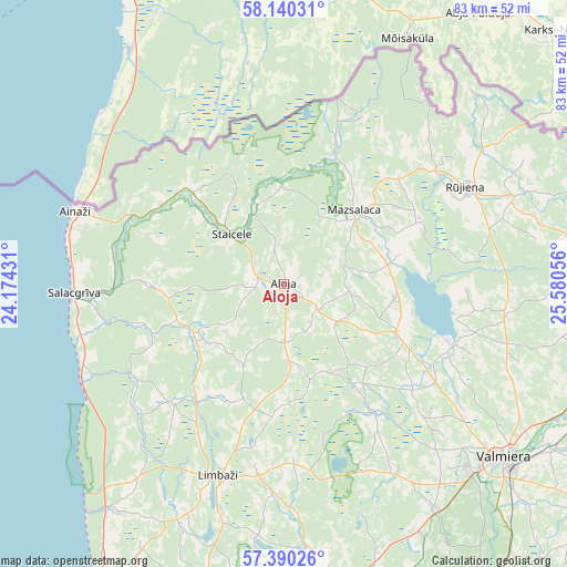
Aloja GPS coordinates[2]
57° 46' 2.028" North, 24° 52' 38.748" East
| Map corner | latitude | longitude |
|---|---|---|
| Upper-left | 58.14031°, | 24.17431° |
| Center: | 57.76723°, | 24.87743° |
| Lower-right: | 57.39026°, | 25.58056° |
| Map W x H: | 83.4×83.4 km | = 51.8×51.8mi |
| max Lat: | 57.89752° ⇑4.3% North |
| Aloja: | 57.76723° |
| min Lat: | ⇓95.7% South 55.75284° |
| min Long | Aloja | max Long |
| 21.01085° | 24.87743° | 28.12165° |
| W 55.7%⇐ | ⇒44.3% E |
Elevation
Elevation of Aloja is 85 m = 279 ft, and this is 19.6 m = 64 ft above average elevation for this country.
| Max E: |
212 m = 696 ft | 34.3% |
| Aloja | 85 m 279 ft | |
| Avg. | 65.4 m = 215 ft | |
Min E: |
2 m = 7 ft | 65.7% |
See also: Latvia elevation on elevation.city.
Geographical zone
Aloja is located in North temperate zone (between Tropic of Cancer and the Arctic Circle). Distance of this North polar circle is 978.1 km =607.8 mi to North.| Distance of | km | miles | from Aloja |
|---|---|---|---|
| North Pole | 3583.9 | 2226.9 | to North |
| Arctic Circle | 978.1 | 607.8 | to North |
| Tropic Cancer | 3817.2 | 2371.9 | to South |
| Equator | 6423.1 | 3991.1 | to South |


Nearby cities:
15 places around Aloja: (largest is in red/bold)
• Ainaži
32.5 km =20.2 mi,  289°
289°
• Cēsis
55.9 km =34.7 mi,  154°
154°
• Kocēni
38.8 km =24.1 mi,  135°
135°
• Limbaži
29.8 km =18.5 mi,  198°
198°
• Matīši
18.4 km =11.4 mi,  114°
114°
• Mazsalaca
15 km =9.3 mi,  44°
44°
• Mūrmuiža
49.1 km =30.5 mi,  131°
131°
• Naukšēni
36.6 km =22.7 mi,  69°
69°
• Rūjiena
30.5 km =19 mi,  61°
61°
• Salacgrīva
30.8 km =19.1 mi,  267°
267°
• Seda
53.5 km =33.2 mi,  104°
104°
• Staicele
10.9 km =6.8 mi,  314°
314°
• Stalbe
45 km =28 mi,  168°
168°
• Strenči
50.5 km =31.4 mi, 108°
• Valmiera
41.3 km =25.7 mi, 127°
Sources, notices
• [Note1] Compared only with cities in Latvia existing in our database
• [Src1] Map data: © OpenStreetMap contributors (CC-BY-SA)
• [Src2] Other city data from geonames.org with taken over terms of usage.
• [Src3] Geographical zone / Annual Mean Temperature by Robert A. Rohde @ Wikipedia
