Moulay Yacoub geodata
Moulay Yacoub (Fès-Meknès) is a seat of a third-order administrative division; located in Morocco in Africa/Casablanca (GMT+1) time zone. In our database, there are 108 cities with bigger population. Compared to other cities in Morocco, 67.4% of cities are located further ↓South; 68.6% of cities are located further ←West and 66.7% of cities have higher elevation than Moulay Yacoub. Note1


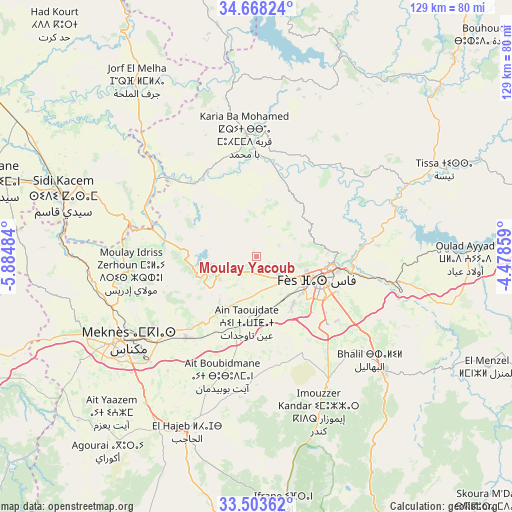
Moulay Yacoub GPS coordinates[2]
34° 5' 16.548" North, 5° 10' 54.156" West
| Map corner | latitude | longitude |
|---|---|---|
| Upper-left | 34.66824°, | -5.88484° |
| Center: | 34.08793°, | -5.18171° |
| Lower-right: | 33.50362°, | -4.47859° |
| Map W x H: | 129.5×129.5 km | = 80.5×80.5mi |
| max Lat: | 35.84906° ⇑32.6% North |
| Moulay Yacoub: | 34.08793° |
| min Lat: | ⇓67.4% South 22.6558° |
| min Long | Moulay Yacoub | max Long |
| -15.60719° | -5.18171° | -1.22855° |
| W 68.6%⇐ | ⇒31.4% E |
Elevation
Elevation of Moulay Yacoub is 254 m = 833 ft, and this is 362.8 m = 1190 ft below average elevation for this country.
| Max E: |
2637 m = 8652 ft | 66.7% |
| Avg. | 616.8 m = 2024 ft | |
| Moulay Yacoub | 254 m = 833 ft | |
Min E: |
1 m = 3 ft | 33.3% |
See also: Morocco elevation on elevation.city.
Geographical zone
Moulay Yacoub is located in North temperate zone (between Tropic of Cancer and the Arctic Circle). Distance of this Northern Tropic circle is 1184.3 km =735.9 mi to South.| Distance of | km | miles | from Moulay Yacoub |
|---|---|---|---|
| North Pole | 6216.8 | 3862.9 | to North |
| Arctic Circle | 3611 | 2243.8 | to North |
| Tropic Cancer | 1184.3 | 735.9 | to South |
| Equator | 3790.2 | 2355.1 | to South |


Nearby cities:
15 places around Moulay Yacoub: (largest is in red/bold)
• Bhalil
38.8 km =24.1 mi,  132°
132°
• Bouarouss
45.6 km =28.3 mi,  48°
48°
• El Hajeb
47.8 km =29.7 mi,  201°
201°
• Fès
17.8 km =11.1 mi,  110°
110°
• Fès al Bali
21 km =13 mi,  95°
95°
• Ghouazi
44.7 km =27.8 mi,  345°
345°
• Karia Ba Mohamed
31.6 km =19.6 mi, 354°
• Meknès
40 km =24.9 mi,  237°
237°
• Moulay Bouchta
44.9 km =27.9 mi,  6°
6°
• Oulad Tayeb
23.3 km =14.5 mi, 132°
• Ourtzagh
53.4 km =33.2 mi,  21°
21°
• Sefrou
43.3 km =26.9 mi, 131°
• Sidi Harazem
28.3 km =17.6 mi, 103°
• Sidi Qacem
50.6 km =31.4 mi,  287°
287°
• Tissa
52.6 km =32.7 mi,  64°
64°
Sources, notices
• [Note1] Compared only with cities in Morocco existing in our database
• [Src1] Map data: © OpenStreetMap contributors (CC-BY-SA)
• [Src2] Other city data from geonames.org with taken over terms of usage.
• [Src3] Geographical zone / Annual Mean Temperature by Robert A. Rohde @ Wikipedia
