Bhalil geodata
Bhalil (Fès-Meknès) is a seat of a third-order administrative division; located in Morocco in Africa/Casablanca (GMT+1) time zone. In our database, there are 108 cities with bigger population. Compared to other cities in Morocco, 61.2% of cities are located further ↓South; 75.6% of cities are located further ←West and 72.9% of cities have lower elevation than Bhalil. Note1


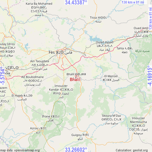
Bhalil GPS coordinates[2]
33° 51' 6.984" North, 4° 52' 20.208" West
| Map corner | latitude | longitude |
|---|---|---|
| Upper-left | 34.43387°, | -5.5754° |
| Center: | 33.85194°, | -4.87228° |
| Lower-right: | 33.26602°, | -4.16915° |
| Map W x H: | 129.9×129.9 km | = 80.7×80.7mi |
| max Lat: | 35.84906° ⇑38.8% North |
| Bhalil: | 33.85194° |
| min Lat: | ⇓61.2% South 22.6558° |
| min Long | Bhalil | max Long |
| -15.60719° | -4.87228° | -1.22855° |
| W 75.6%⇐ | ⇒24.4% E |
Elevation
Elevation of Bhalil is 945 m = 3100 ft, and this is 328.2 m = 1077 ft above average elevation for this country.
| Max E: |
2637 m = 8652 ft | 27.1% |
| Bhalil | 945 m 3100 ft | |
| Avg. | 616.8 m = 2024 ft | |
Min E: |
1 m = 3 ft | 72.9% |
See also: Morocco elevation on elevation.city.
Geographical zone
Bhalil is located in North temperate zone (between Tropic of Cancer and the Arctic Circle). Distance of this Northern Tropic circle is 1158.1 km =719.6 mi to South.| Distance of | km | miles | from Bhalil |
|---|---|---|---|
| North Pole | 6243.1 | 3879.3 | to North |
| Arctic Circle | 3637.2 | 2260.1 | to North |
| Tropic Cancer | 1158.1 | 719.6 | to South |
| Equator | 3764 | 2338.8 | to South |


Nearby cities:
15 places around Bhalil: (largest is in red/bold)
• Azrou
56.6 km =35.2 mi,  214°
214°
• Bouarouss
56.8 km =35.3 mi,  5°
5°
• Boulemane
55.9 km =34.7 mi,  166°
166°
• El Hajeb
49.6 km =30.8 mi,  248°
248°
• Fès
23.4 km =14.5 mi,  329°
329°
• Fès al Bali
25.4 km =15.8 mi,  342°
342°
• Ifrane
42.3 km =26.3 mi, 211°
• Matmata
40.3 km =25 mi,  47°
47°
• Moulay Yacoub
38.8 km =24.1 mi,  312°
312°
• Oulad Tayeb
15.4 km =9.6 mi, 312°
• Sefrou
4.7 km =2.9 mi,  118°
118°
• Sidi Harazem
19.5 km =12.1 mi,  356°
356°
• Tahla
47 km =29.2 mi,  62°
62°
• Tazouta
29.9 km =18.6 mi,  132°
132°
• Tissa
52.1 km =32.4 mi,  21°
21°
Sources, notices
• [Note1] Compared only with cities in Morocco existing in our database
• [Src1] Map data: © OpenStreetMap contributors (CC-BY-SA)
• [Src2] Other city data from geonames.org with taken over terms of usage.
• [Src3] Geographical zone / Annual Mean Temperature by Robert A. Rohde @ Wikipedia
