Guenfouda geodata
Guenfouda (Oriental) is a seat of a third-order administrative division; located in Morocco in Africa/Casablanca (GMT+1) time zone. In our database, there are 108 cities with bigger population. Compared to other cities in Morocco, 74% of cities are located further ↓South; 98.1% of cities are located further ←West and 65.5% of cities have lower elevation than Guenfouda. Note1


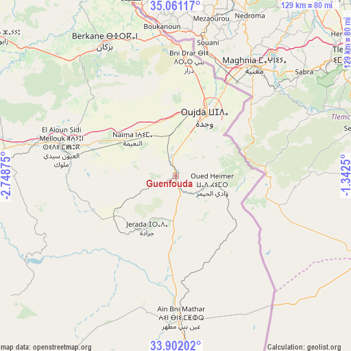
Guenfouda GPS coordinates[2]
34° 29' 0.996" North, 2° 2' 44.232" West
| Map corner | latitude | longitude |
|---|---|---|
| Upper-left | 35.06117°, | -2.74875° |
| Center: | 34.48361°, | -2.04562° |
| Lower-right: | 33.90202°, | -1.3425° |
| Map W x H: | 128.9×128.9 km | = 80.1×80.1mi |
| max Lat: | 35.84906° ⇑26% North |
| Guenfouda: | 34.48361° |
| min Lat: | ⇓74% South 22.6558° |
| min Long | Guenfouda | max Long |
| -15.60719° | -2.04562° | -1.22855° |
| W 98.1%⇐ | ⇒1.9% E |
Elevation
Elevation of Guenfouda is 818 m = 2684 ft, and this is 201.2 m = 660 ft above average elevation for this country.
| Max E: |
2637 m = 8652 ft | 34.5% |
| Guenfouda | 818 m 2684 ft | |
| Avg. | 616.8 m = 2024 ft | |
Min E: |
1 m = 3 ft | 65.5% |
See also: Morocco elevation on elevation.city.
Geographical zone
Guenfouda is located in North temperate zone (between Tropic of Cancer and the Arctic Circle). Distance of this Northern Tropic circle is 1228.3 km =763.2 mi to South.| Distance of | km | miles | from Guenfouda |
|---|---|---|---|
| North Pole | 6172.8 | 3835.6 | to North |
| Arctic Circle | 3567 | 2216.4 | to North |
| Tropic Cancer | 1228.3 | 763.2 | to South |
| Equator | 3834.2 | 2382.5 | to South |


Nearby cities:
15 places around Guenfouda: (largest is in red/bold)
• Ahfir
52.5 km =32.6 mi,  354°
354°
• Aïn Beni Mathar
52.7 km =32.7 mi,  178°
178°
• Berkane
54.6 km =33.9 mi,  332°
332°
• El Aïoun
43.6 km =27.1 mi,  284°
284°
• Hassi Berkane
84.9 km =52.8 mi,  297°
297°
• Jerada
22 km =13.7 mi,  208°
208°
• Kariat Arkmane
94.4 km =58.7 mi,  317°
317°
• Madagh
64.3 km =40 mi,  335°
335°
• Mosquée
49.2 km =30.6 mi, 316°
• Oujda-Angad
25.3 km =15.7 mi,  29°
29°
• Rislane
49.5 km =30.8 mi,  309°
309°
• Saidia
68.6 km =42.6 mi, 345°
• Taourirt
78.6 km =48.8 mi,  263°
263°
• Tiouli
23.1 km =14.4 mi,  124°
124°
• Zaïo
81 km =50.3 mi, 309°
Sources, notices
• [Note1] Compared only with cities in Morocco existing in our database
• [Src1] Map data: © OpenStreetMap contributors (CC-BY-SA)
• [Src2] Other city data from geonames.org with taken over terms of usage.
• [Src3] Geographical zone / Annual Mean Temperature by Robert A. Rohde @ Wikipedia
