Aïn Beni Mathar geodata
Aïn Beni Mathar (Oriental) is a populated place; located in Morocco in Africa/Casablanca (GMT+1) time zone. With population of 16,289 people, there are 82 cities with bigger population in this country. Compared to other cities in Morocco, 64.7% of cities are located further ↓South; 98.4% of cities are located further ←West and 70.9% of cities have lower elevation than Aïn Beni Mathar. Note1


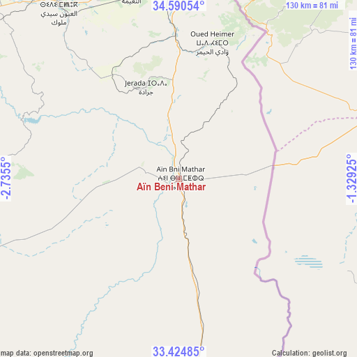
Aïn Beni Mathar GPS coordinates[2]
34° 0' 34.92" North, 2° 1' 56.568" West
| Map corner | latitude | longitude |
|---|---|---|
| Upper-left | 34.59054°, | -2.7355° |
| Center: | 34.0097°, | -2.03238° |
| Lower-right: | 33.42485°, | -1.32925° |
| Map W x H: | 129.6×129.6 km | = 80.5×80.5mi |
| max Lat: | 35.84906° ⇑35.3% North |
| Aïn Beni Mathar: | 34.0097° |
| min Lat: | ⇓64.7% South 22.6558° |
| min Long | Aïn Beni Matha | max Long |
| -15.60719° | -2.03238° | -1.22855° |
| W 98.4%⇐ | ⇒1.6% E |
Elevation
Elevation of Aïn Beni Mathar is 917 m = 3009 ft, and this is 300.2 m = 985 ft above average elevation for this country.
| Max E: |
2637 m = 8652 ft | 29.1% |
| Aïn Beni Mathar | 917 m 3009 ft | |
| Avg. | 616.8 m = 2024 ft | |
Min E: |
1 m = 3 ft | 70.9% |
See also: Morocco elevation on elevation.city.
Geographical zone
Aïn Beni Mathar is located in North temperate zone (between Tropic of Cancer and the Arctic Circle). Distance of this Northern Tropic circle is 1175.6 km =730.5 mi to South.| Distance of | km | miles | from Aïn Beni Mathar |
|---|---|---|---|
| North Pole | 6225.5 | 3868.3 | to North |
| Arctic Circle | 3619.6 | 2249.1 | to North |
| Tropic Cancer | 1175.6 | 730.5 | to South |
| Equator | 3781.5 | 2349.7 | to South |


Nearby cities:
15 places around Aïn Beni Mathar: (largest is in red/bold)
• Ahfir
105.1 km =65.3 mi,  356°
356°
• Berkane
104.6 km =65 mi,  345°
345°
• Debdou
93.2 km =57.9 mi,  268°
268°
• El Aïoun
77.2 km =48 mi,  325°
325°
• Guenfouda
52.7 km =32.7 mi, 358°
• Hassi Berkane
119.8 km =74.4 mi,  320°
320°
• Jerada
35.4 km =22 mi,  340°
340°
• Madagh
114.7 km =71.3 mi, 345°
• Mosquée
95.2 km =59.2 mi, 338°
• Oujda-Angad
75.5 km =46.9 mi,  8°
8°
• Rislane
93.2 km =57.9 mi, 335°
• Saidia
120.6 km =74.9 mi, 351°
• Taourirt
91 km =56.5 mi,  299°
299°
• Tiouli
43.6 km =27.1 mi,  24°
24°
• Zaïo
122 km =75.8 mi, 328°
Sources, notices
• [Note1] Compared only with cities in Morocco existing in our database
• [Src1] Map data: © OpenStreetMap contributors (CC-BY-SA)
• [Src2] Other city data from geonames.org with taken over terms of usage.
• [Src3] Geographical zone / Annual Mean Temperature by Robert A. Rohde @ Wikipedia
