Ihbulag geodata
Ihbulag (Ömnögovĭ) is a seat of a second-order administrative division; located in Mongolia in Asia/Ulaanbaatar (GMT+8) time zone. In our database, there are 33 cities with bigger population. Compared to other cities in Mongolia, 98.8% of cities are located further ↑North; 78.5% of cities are located further ←West and 75.2% of cities have higher elevation than Ihbulag. Note1


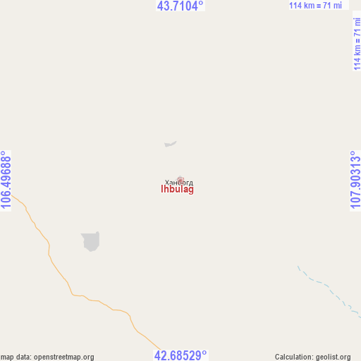
Ihbulag GPS coordinates[2]
43° 12' 0" North, 107° 12' 0" East
| Map corner | latitude | longitude |
|---|---|---|
| Upper-left | 43.7104°, | 106.49688° |
| Center: | 43.2°, | 107.2° |
| Lower-right: | 42.68529°, | 107.90313° |
| Map W x H: | 114×114 km | = 70.8×70.8mi |
| max Lat: | 51.50725° ⇑98.8% North |
| Ihbulag: | 43.2° |
| min Lat: | ⇓1.2% South 42.84199° |
| min Long | Ihbulag | max Long |
| 89.14358° | 107.2° | 118.51014° |
| W 78.5%⇐ | ⇒21.5% E |
Elevation
Elevation of Ihbulag is 1103 m = 3619 ft, and this is 313.5 m = 1029 ft below average elevation for this country.
| Max E: |
2800 m = 9186 ft | 75.2% |
| Avg. | 1416.5 m = 4647 ft | |
| Ihbulag | 1103 m = 3619 ft | |
Min E: |
619 m = 2031 ft | 24.8% |
See also: Mongolia elevation on elevation.city.
Geographical zone
Ihbulag is located in North temperate zone (between Tropic of Cancer and the Arctic Circle). Distance of this Northern Tropic circle is 2197.5 km =1365.5 mi to South.| Distance of | km | miles | from Ihbulag |
|---|---|---|---|
| North Pole | 5203.7 | 3233.4 | to North |
| Arctic Circle | 2597.8 | 1614.2 | to North |
| Tropic Cancer | 2197.5 | 1365.5 | to South |
| Equator | 4803.4 | 2984.7 | to South |


Nearby cities:
15 places around Ihbulag: (largest is in red/bold)
• Baruunsuu
127.2 km =79 mi,  293°
293°
• Böhöt
241.9 km =150.3 mi,  20°
20°
• Dalandzadgad
228 km =141.7 mi,  280°
280°
• Doloon
203.1 km =126.2 mi,  312°
312°
• Erdenetsogt
91.4 km =56.8 mi,  253°
253°
• Ergel
156.9 km =97.5 mi,  92°
92°
• Khuvsget
202.1 km =125.6 mi,  77°
77°
• Naran-mandokhu Somon
157.8 km =98.1 mi,  32°
32°
• Rashaant
246.7 km =153.3 mi,  341°
341°
• Sangiyn Dalay
172.3 km =107.1 mi,  256°
256°
• Tsoohor
253.4 km =157.5 mi,  272°
272°
• Ulaanjirem
243.5 km =151.3 mi,  327°
327°
• Ögöömör
228.7 km =142.1 mi, 286°
• Öldziyt
219.9 km =136.6 mi,  41°
41°
• Üydzen
101.6 km =63.1 mi, 344°
Sources, notices
• [Note1] Compared only with cities in Mongolia existing in our database
• [Src1] Map data: © OpenStreetMap contributors (CC-BY-SA)
• [Src2] Other city data from geonames.org with taken over terms of usage.
• [Src3] Geographical zone / Annual Mean Temperature by Robert A. Rohde @ Wikipedia
