Doloon geodata
Doloon (Ömnögovĭ) is a seat of a second-order administrative division; located in Mongolia in Asia/Ulaanbaatar (GMT+8) time zone. In our database, there are 33 cities with bigger population. Compared to other cities in Mongolia, 94.5% of cities are located further ↑North; 65% of cities are located further ←West and 56.7% of cities have higher elevation than Doloon. Note1


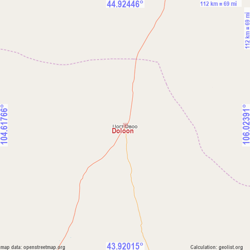
Doloon GPS coordinates[2]
44° 25' 28.056" North, 105° 19' 14.808" East
| Map corner | latitude | longitude |
|---|---|---|
| Upper-left | 44.92446°, | 104.61766° |
| Center: | 44.42446°, | 105.32078° |
| Lower-right: | 43.92015°, | 106.02391° |
| Map W x H: | 111.7×111.7 km | = 69.4×69.4mi |
| max Lat: | 51.50725° ⇑94.5% North |
| Doloon: | 44.42446° |
| min Lat: | ⇓5.5% South 42.84199° |
| min Long | Doloon | max Long |
| 89.14358° | 105.32078° | 118.51014° |
| W 65%⇐ | ⇒35% E |
Elevation
Elevation of Doloon is 1297 m = 4255 ft, and this is 119.5 m = 392 ft below average elevation for this country.
| Max E: |
2800 m = 9186 ft | 56.7% |
| Avg. | 1416.5 m = 4647 ft | |
| Doloon | 1297 m = 4255 ft | |
Min E: |
619 m = 2031 ft | 43.3% |
See also: Mongolia elevation on elevation.city.
Geographical zone
Doloon is located in North temperate zone (between Tropic of Cancer and the Arctic Circle). Distance of this Northern Tropic circle is 2333.6 km =1450 mi to South.| Distance of | km | miles | from Doloon |
|---|---|---|---|
| North Pole | 5067.5 | 3148.8 | to North |
| Arctic Circle | 2461.6 | 1529.6 | to North |
| Tropic Cancer | 2333.6 | 1450 | to South |
| Equator | 4939.5 | 3069.3 | to South |


Nearby cities:
15 places around Doloon: (largest is in red/bold)
• Baruunsuu
92.3 km =57.4 mi,  157°
157°
• Bulgan
146.2 km =90.8 mi,  255°
255°
• Dalandzadgad
118.9 km =73.9 mi,  217°
217°
• Erdenetsogt
173.7 km =107.9 mi, 158°
• Hashaat
99.7 km =62 mi,  335°
335°
• Mandalgovi
166.4 km =103.4 mi,  26°
26°
• Ongi
159.7 km =99.2 mi,  315°
315°
• Rashaant
119.5 km =74.3 mi,  35°
35°
• Sangiyn Dalay
176.6 km =109.7 mi,  184°
184°
• Sharhulsan
103.8 km =64.5 mi,  283°
283°
• Tsagaan-Ovoo
125.2 km =77.8 mi,  15°
15°
• Tsoohor
159.5 km =99.1 mi, 218°
• Ulaanjirem
72.2 km =44.9 mi, 15°
• Ögöömör
97.9 km =60.8 mi, 223°
• Üydzen
129.1 km =80.2 mi,  107°
107°
Sources, notices
• [Note1] Compared only with cities in Mongolia existing in our database
• [Src1] Map data: © OpenStreetMap contributors (CC-BY-SA)
• [Src2] Other city data from geonames.org with taken over terms of usage.
• [Src3] Geographical zone / Annual Mean Temperature by Robert A. Rohde @ Wikipedia
