Öldziyt geodata
Öldziyt (East Gobi Aymag) is a seat of a second-order administrative division; located in Mongolia in Asia/Ulaanbaatar (GMT+8) time zone. In our database, there are 33 cities with bigger population. Compared to other cities in Mongolia, 92.3% of cities are located further ↑North; 83.1% of cities are located further ←West and 64.1% of cities have higher elevation than Öldziyt. Note1


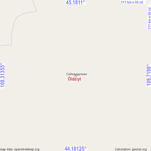
Öldziyt GPS coordinates[2]
44° 40' 59.988" North, 109° 1' 0.012" East
| Map corner | latitude | longitude |
|---|---|---|
| Upper-left | 45.1811°, | 108.31355° |
| Center: | 44.68333°, | 109.01667° |
| Lower-right: | 44.18125°, | 109.7198° |
| Map W x H: | 111.2×111.2 km | = 69.1×69.1mi |
| max Lat: | 51.50725° ⇑92.3% North |
| Öldziyt: | 44.68333° |
| min Lat: | ⇓7.7% South 42.84199° |
| min Long | Öldziyt | max Long |
| 89.14358° | 109.01667° | 118.51014° |
| W 83.1%⇐ | ⇒16.9% E |
Elevation
Elevation of Öldziyt is 1245 m = 4085 ft, and this is 171.5 m = 563 ft below average elevation for this country.
| Max E: |
2800 m = 9186 ft | 64.1% |
| Avg. | 1416.5 m = 4647 ft | |
| Öldziyt | 1245 m = 4085 ft | |
Min E: |
619 m = 2031 ft | 35.9% |
See also: Mongolia elevation on elevation.city.
Geographical zone
Öldziyt is located in North temperate zone (between Tropic of Cancer and the Arctic Circle). Distance of this Northern Tropic circle is 2362.4 km =1467.9 mi to South.| Distance of | km | miles | from Öldziyt |
|---|---|---|---|
| North Pole | 5038.7 | 3130.9 | to North |
| Arctic Circle | 2432.9 | 1511.7 | to North |
| Tropic Cancer | 2362.4 | 1467.9 | to South |
| Equator | 4968.3 | 3087.2 | to South |


Nearby cities:
15 places around Öldziyt: (largest is in red/bold)
• Argatay
145.1 km =90.2 mi,  326°
326°
• Böhöt
84 km =52.2 mi,  316°
316°
• Chandmanĭ
147.9 km =91.9 mi,  50°
50°
• Ergel
170.7 km =106.1 mi,  176°
176°
• Khuvsget
129.6 km =80.5 mi,  157°
157°
• Naran-mandokhu Somon
68.4 km =42.5 mi,  242°
242°
• Nüden
168.4 km =104.6 mi,  136°
136°
• Saynshand
89.6 km =55.7 mi,  75°
75°
• Senj
138.4 km =86 mi,  88°
88°
• Shiveegovĭ
161.1 km =100.1 mi,  348°
348°
• Suugaant
181.2 km =112.6 mi,  301°
301°
• Tsagaandörvölj
126.2 km =78.4 mi,  10°
10°
• Tsomog
137.2 km =85.3 mi,  1°
1°
• Ulaan-Uul
180 km =111.8 mi,  102°
102°
• Üydzen
183.2 km =113.8 mi,  248°
248°
Sources, notices
• [Note1] Compared only with cities in Mongolia existing in our database
• [Src1] Map data: © OpenStreetMap contributors (CC-BY-SA)
• [Src2] Other city data from geonames.org with taken over terms of usage.
• [Src3] Geographical zone / Annual Mean Temperature by Robert A. Rohde @ Wikipedia
