Ögöömör geodata
Ögöömör (Ömnögovĭ) is a seat of a second-order administrative division; located in Mongolia in Asia/Ulaanbaatar (GMT+8) time zone. In our database, there are 33 cities with bigger population. Compared to other cities in Mongolia, 96% of cities are located further ↑North; 60.4% of cities are located further ←West and 64.4% of cities have lower elevation than Ögöömör. Note1


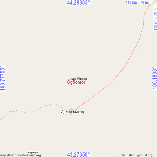
Ögöömör GPS coordinates[2]
43° 47' 0.096" North, 104° 28' 50.412" East
| Map corner | latitude | longitude |
|---|---|---|
| Upper-left | 44.28883°, | 103.77755° |
| Center: | 43.78336°, | 104.48067° |
| Lower-right: | 43.27358°, | 105.1838° |
| Map W x H: | 112.9×112.9 km | = 70.2×70.2mi |
| max Lat: | 51.50725° ⇑96% North |
| Ögöömör: | 43.78336° |
| min Lat: | ⇓4% South 42.84199° |
| min Long | Ögöömör | max Long |
| 89.14358° | 104.48067° | 118.51014° |
| W 60.4%⇐ | ⇒39.6% E |
Elevation
Elevation of Ögöömör is 1517 m = 4977 ft, and this is 100.5 m = 330 ft above average elevation for this country.
| Max E: |
2800 m = 9186 ft | 35.6% |
| Ögöömör | 1517 m 4977 ft | |
| Avg. | 1416.5 m = 4647 ft | |
Min E: |
619 m = 2031 ft | 64.4% |
See also: Mongolia elevation on elevation.city.
Geographical zone
Ögöömör is located in North temperate zone (between Tropic of Cancer and the Arctic Circle). Distance of this Northern Tropic circle is 2262.3 km =1405.7 mi to South.| Distance of | km | miles | from Ögöömör |
|---|---|---|---|
| North Pole | 5138.8 | 3193.1 | to North |
| Arctic Circle | 2532.9 | 1573.9 | to North |
| Tropic Cancer | 2262.3 | 1405.7 | to South |
| Equator | 4868.3 | 3025 | to South |


Nearby cities:
15 places around Ögöömör: (largest is in red/bold)
• Baruunsuu
103.4 km =64.2 mi,  97°
97°
• Bulgan
82.8 km =51.4 mi,  294°
294°
• Dalandzadgad
24.1 km =15 mi,  190°
190°
• Dalay
85.4 km =53.1 mi,  245°
245°
• Doloon
97.9 km =60.8 mi,  43°
43°
• Erdenetsogt
160.2 km =99.5 mi,  124°
124°
• Hashaat
164.3 km =102.1 mi,  9°
9°
• Hovd
193.8 km =120.4 mi,  300°
300°
• Ongi
190.9 km =118.6 mi,  346°
346°
• Sangiyn Dalay
117.4 km =72.9 mi,  153°
153°
• Saynshand
157.6 km =97.9 mi,  263°
263°
• Sharhulsan
102.3 km =63.6 mi,  340°
340°
• Tsoohor
62.3 km =38.7 mi,  211°
211°
• Ulaanjirem
165.1 km =102.6 mi,  31°
31°
• Üydzen
194.2 km =120.7 mi,  80°
80°
Sources, notices
• [Note1] Compared only with cities in Mongolia existing in our database
• [Src1] Map data: © OpenStreetMap contributors (CC-BY-SA)
• [Src2] Other city data from geonames.org with taken over terms of usage.
• [Src3] Geographical zone / Annual Mean Temperature by Robert A. Rohde @ Wikipedia
