Bulgan geodata
Bulgan (Ömnögovĭ) is a seat of a second-order administrative division; located in Mongolia in Asia/Ulaanbaatar (GMT+8) time zone. In our database, there are 33 cities with bigger population. Compared to other cities in Mongolia, 95.4% of cities are located further ↑North; 55.5% of cities are located further ←West and 57.1% of cities have higher elevation than Bulgan. Note1


Bulgan GPS coordinates[2]
44° 5' 50.82" North, 103° 32' 34.368" East
| Map corner | latitude | longitude |
|---|---|---|
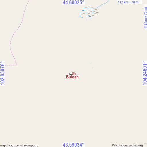
| Upper-left | 44.60025°, | 102.83976° |
| Center: | 44.09745°, | 103.54288° |
| Lower-right: | 43.59034°, | 104.24601° |
| Map W x H: | 112.3×112.3 km | = 69.8×69.8mi |
| max Lat: | 51.50725° ⇑95.4% North |
| Bulgan: | 44.09745° |
| min Lat: | ⇓4.6% South 42.84199° |
| min Long | Bulgan | max Long |
| 89.14358° | 103.54288° | 118.51014° |
| W 55.5%⇐ | ⇒44.5% E |
Elevation
Elevation of Bulgan is 1296 m = 4252 ft, and this is 120.5 m = 395 ft below average elevation for this country.
| Max E: |
2800 m = 9186 ft | 57.1% |
| Avg. | 1416.5 m = 4647 ft | |
| Bulgan | 1296 m = 4252 ft | |
Min E: |
619 m = 2031 ft | 42.9% |
See also: Mongolia elevation on elevation.city.
Geographical zone
Bulgan is located in North temperate zone (between Tropic of Cancer and the Arctic Circle). Distance of this Northern Tropic circle is 2297.3 km =1427.5 mi to South.| Distance of | km | miles | from Bulgan |
|---|---|---|---|
| North Pole | 5103.9 | 3171.4 | to North |
| Arctic Circle | 2498 | 1552.2 | to North |
| Tropic Cancer | 2297.3 | 1427.5 | to South |
| Equator | 4903.2 | 3046.7 | to South |


Nearby cities:
15 places around Bulgan: (largest is in red/bold)
• Arguut
175.8 km =109.2 mi,  329°
329°
• Baruunsuu
184 km =114.3 mi,  105°
105°
• Dalandzadgad
91.8 km =57 mi,  129°
129°
• Dalay
70 km =43.5 mi,  181°
181°
• Doloon
146.2 km =90.8 mi,  75°
75°
• Hashaat
161.8 km =100.5 mi,  38°
38°
• Hoolt
165.6 km =102.9 mi,  344°
344°
• Hovd
111.8 km =69.5 mi,  304°
304°
• Hovd
126 km =78.3 mi, 300°
• Noyon Suma
153.1 km =95.1 mi,  227°
227°
• Ongi
153 km =95.1 mi,  10°
10°
• Saynshand
97 km =60.3 mi,  236°
236°
• Sharhulsan
73.5 km =45.7 mi,  33°
33°
• Tsoohor
97.8 km =60.8 mi,  154°
154°
• Ögöömör
82.8 km =51.4 mi, 114°
Sources, notices
• [Note1] Compared only with cities in Mongolia existing in our database
• [Src1] Map data: © OpenStreetMap contributors (CC-BY-SA)
• [Src2] Other city data from geonames.org with taken over terms of usage.
• [Src3] Geographical zone / Annual Mean Temperature by Robert A. Rohde @ Wikipedia
